CCN Weather Update for Thursday April 30, 2026
This weather update is sponsored by Freedom Insurance of Whiteville. Trust Freedom Insurance to give you clear blue skies when it comes to home, car, boat, or whatever insurance you need. Let Freedom provide customized coverage to keep you and your family safe. Contact Freedom today at 910-640-2828!
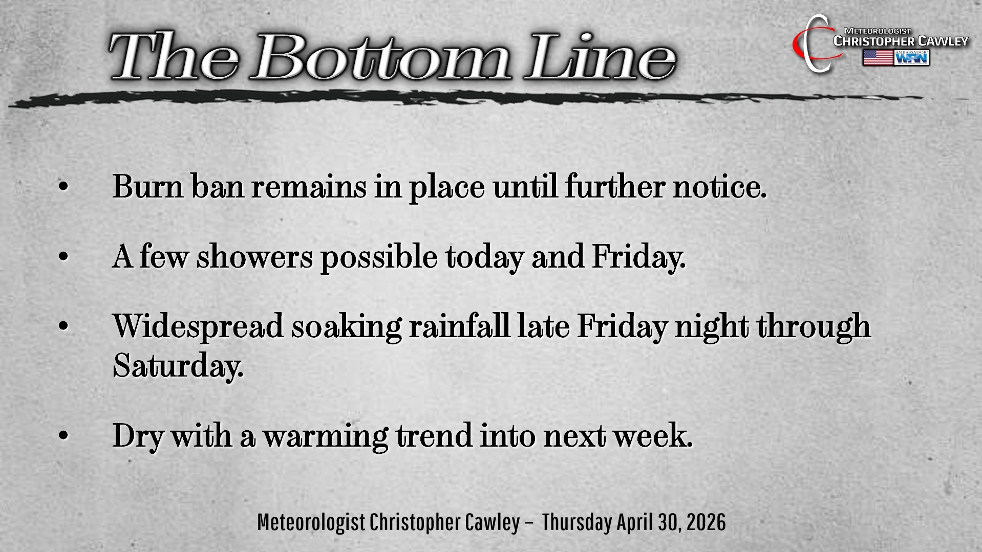
Here’s today’s Bottom Line
Right off the bat, let’s take a look at the forecast #bust yesterday. Basically the system that was SUPPOSED TO have brought rain to the area had very little overall moisture to work with. It was being supported by upper-level (upper atmosphere) energy … but that energy collapsed as the system approached the Carolinas. Nothing that could have been predicted.
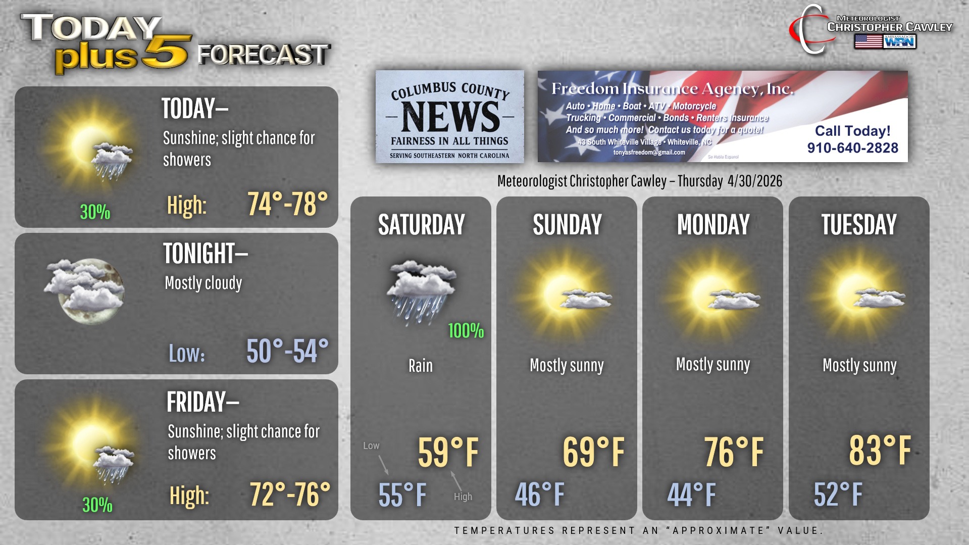
We’ll close out the month of April on quiet terms with weak high pressure over the area. Today and tomorrow will feature partly to mostly sunny skies with isolated showers and thunderstorms possible.
Then our attention turns to Friday night through Saturday and the absolute soaking we’re likely to get.
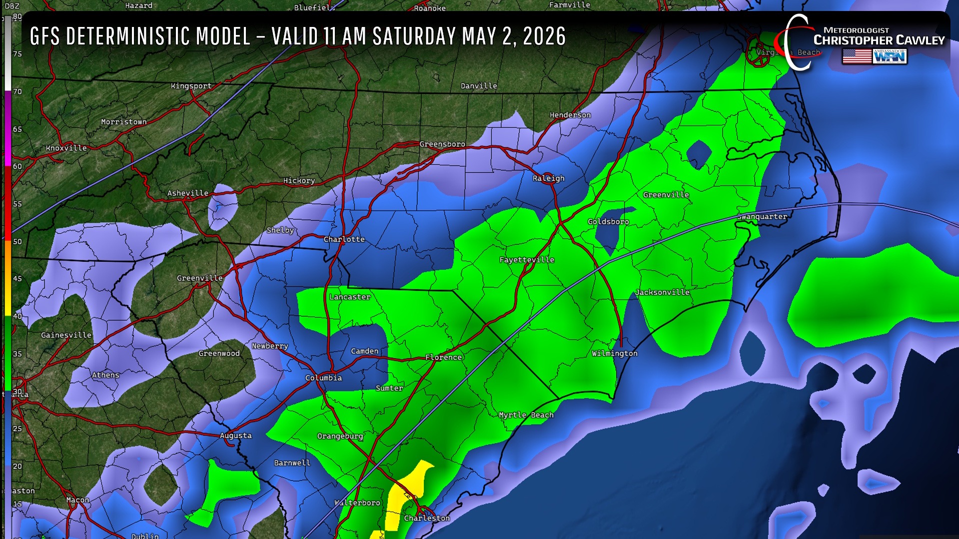
So here’s what sets this system apart from the one we missed yesterday. Saturday’s system will be on the southern jet stream. This will “phase” (combine) with upper-level energy likely to dive southeast over North Carolina early Saturday morning. Low pressure rapidly strengthens off the coast, and the nearly unlimited moisture from the Gulf is pulled northeast into the system. All of this results in widespread “stratiform” rain. We will likely experience at least 8 to 12 hours of solid cold rain in what is a very winter-like setup.
Factors favoring significant rain:
Unlimited Gulf moisture…. check.
Southern-stream low pressure…. check.
Deepening low off the coast…. check.
Upper-level energy/support moving in from the northwest…. check… maybe.
What could go wrong? The upper-level energy modeled to dive southeastward over NC. If that upper-level support doesn’t materialize, we will still get a good bit of rain, but it will cut down on the overall amounts quite a bit.
RAINFALL AMOUNTS:
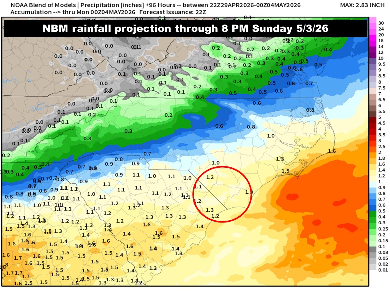
A broad paintbrush of around 1.25 inches appears likely. NWS NDFD projections are slightly higher, coming in at 1.25 to 1.4 inches. Either way, while it won’t BREAK the drought, it’ll but a good dent in the fender, and might end the burn ban at least locally.
I know this comes at the expense of the Strawberry Festival, but the Festival goes on, rain or shine. Just bring a jacket and an umbrella because it’s going to be cold and rainy.
I’m going with 100% rain chances on Saturday.
High pressure then builds in for next week. We’ll start off with some cool temps on Sunday, but they’ll rapidly increase through Tuesday.
Here is your Freedom Insurance Today-plus-Five Forecast:
–Meteorologist Christopher Cawley