Greetings friends and neighbors, and good day to you! Welcome to the CCN Weather Update for Monday May 5, 2025!
This weather update is sponsored by Freedom Insurance of Whiteville. Protect what matters most with Freedom Insurance. Life can be full of surprises, but with Freedom Insurance, you will always be prepared. Whether it’s your home, car, business, or health, we provide customized coverage to keep you and your family safe. Contact Freedom today at 910-640-2828!
STATISTICS for Sunday 5/4/2025
High: 80.4°F at 4:52 PM (Normal 79)
Low: 60.7°F at 6:53 AM (Normal 56)
Precip: 2.54 in

View real-time data from the weather station at College Street Weather Station.
Here’s today’s Bottom Line

Repeated showers and thunderstorms impacted central Columbus County yesterday in a situation known as “training.” Like cars on a train, the storms lifted SSW to NNE one right behind the other and dumped significant rainfall amounts to portions of the area. Rainfall amounts varied widely outside of this training area, and because of that I’m doubtful the US Drought Monitor folks will reduce our overall drought status.
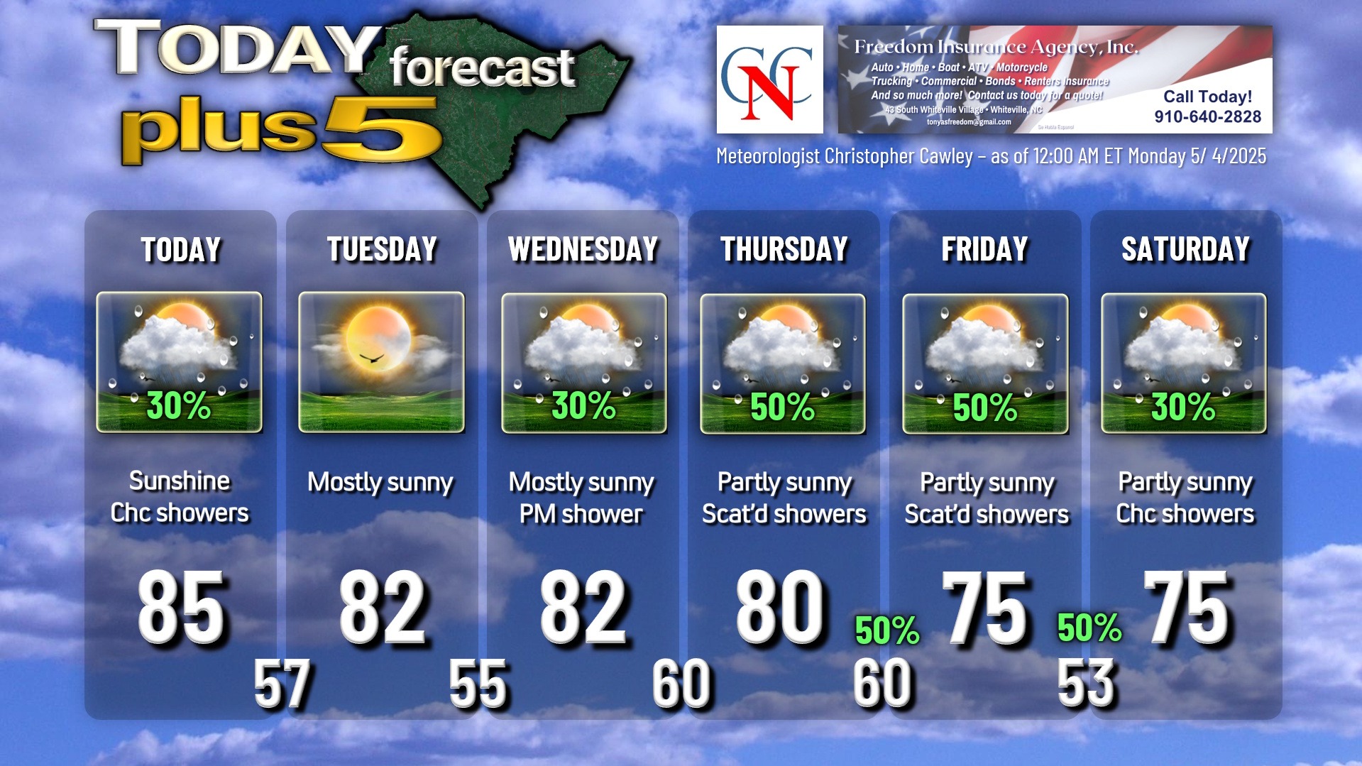
This week will feature some dry weather and then more unsettled conditions with another frontal system later in the week.
The frontal system responsible for all of this is in the dying phase, but remains in place today just inland from the coast. This will be the focus for a few scattered showers today… I don’t think we’ll see anything nearly as widespread as we did on Sunday… but some showers and perhaps a thunderstorm can be expected.
The front fades away off the coast tonight, and an area of high pressure builds in for Tuesday. Tuesday will be the only day this week that will remain dry.
The next front starts to approach on Wednesday, and moisture starts to build once again. Rain chances should be fairly low on Wednesday, but then ramp up considerably Thursday into Friday. The front will become “zonal” in orientation – west to east – therefore getting essentially cut-off. With the wind flow parallel to the front, there’ll be no incentive for this front to go anywhere… it may drift southward just south of the state line for your Friday into Saturday as an area of low pressure pushes into the northeast US. There is a good deal of uncertainty with this outlook toward the weekend; the Euro modeling suggests the front pushes/pivots to the coast with an area of low pressure forming along it. That’s an outlier right now, but as it is the Euro, it needs to be monitored. As of right now, I’m carrying a 30% chance for showers on Saturday but if that low develops, a much more wet solution is possible.
We won’t have any all-day washouts this week, but situations in which the day starts off dry, with showers and thunderstorms likely in the afternoon and evening, with drying conditions overnight. This will be the rule late Wednesday into the weekend. I’m going with cooler temps for Friday and Saturday on the assumption that the frontal boundary will dip south and then east of Columbus County.
Here is your Freedom Insurance Today-plus-Five Forecast:
That’s going to do it for today’s report. As always, thank you for reading and for supporting Columbus County News. Have a great day!
–Meteorologist Christopher Cawley