CCN Weather Update for Tuesday July 8, 2025.
This weather update is sponsored by Freedom Insurance of Whiteville. No weather worries with Freedom Insurance. For home, car, boat, or whatever you need, Freedom can provide customized coverage to keep you and your family safe. Contact Freedom today at 910-640-2828!
Here’s today’s Bottom Line
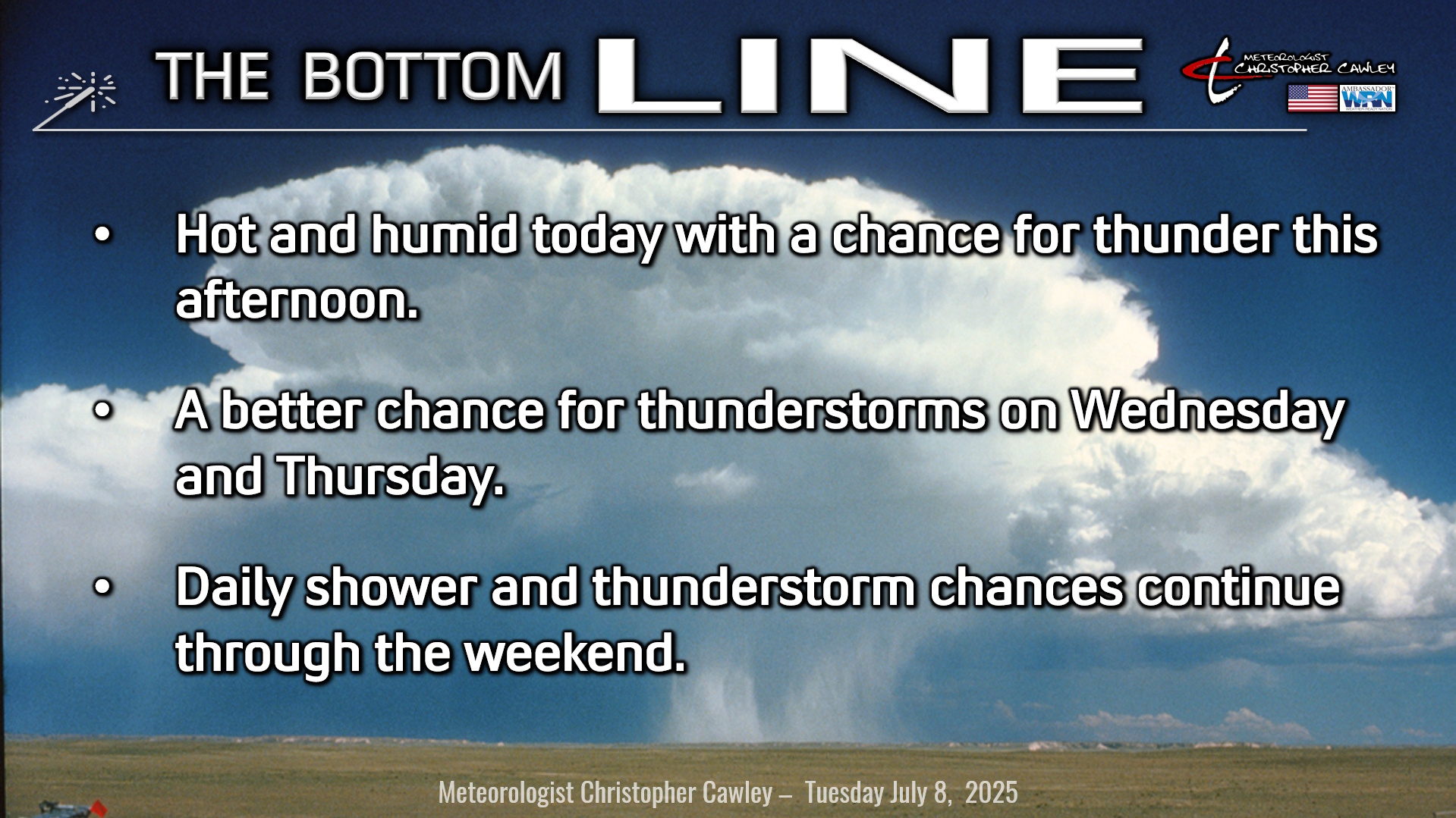
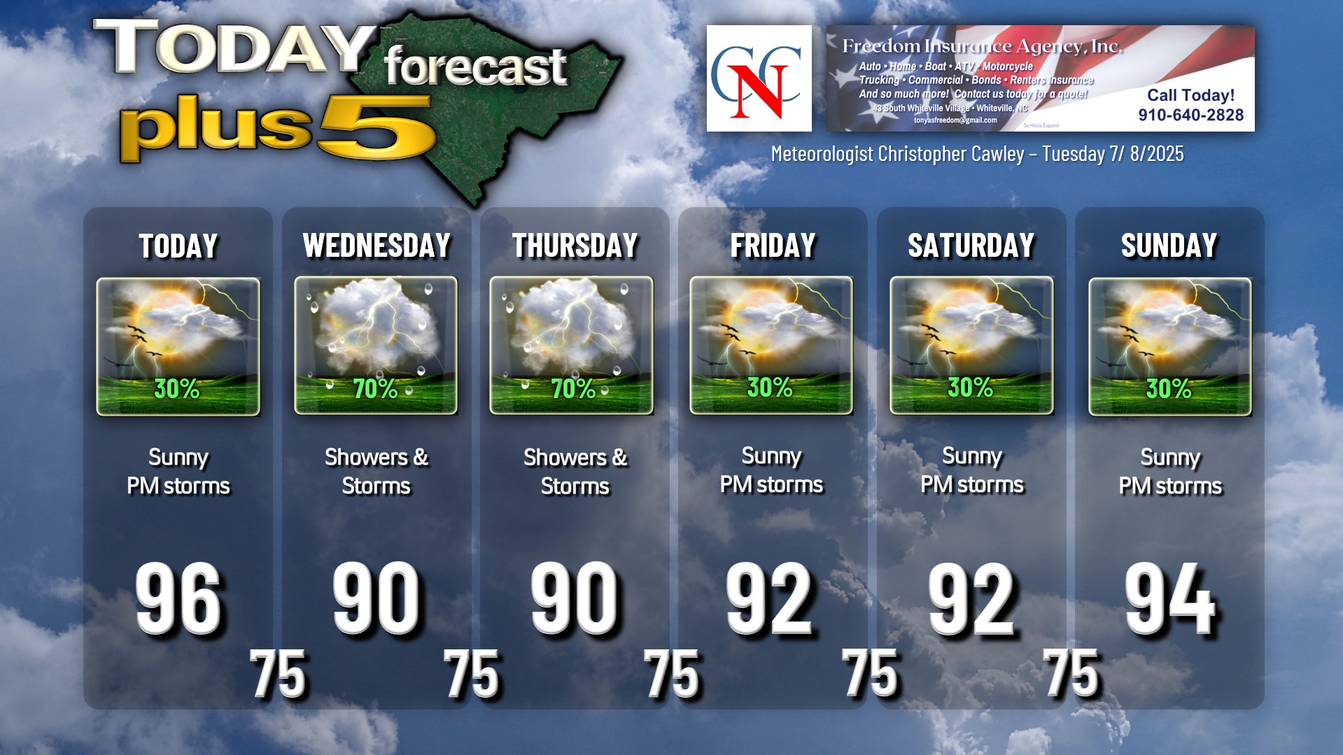
My Lanta it was hot yesterday as the summertime pattern got back into full force behind the tropical storm. Today will feature much of the same conditions with hot temperatures, lots of sunshine, and a few spotty thunderstorms this afternoon.
We reached a high yesterday on my weather station in Whiteville of 97.7°F. Because of that, and because conditions today will be similar, I put a “96” on the graphic below. Unless we get a thunderstorm, I believe we’ll see those highs again today.
Heat index values will likely top the 105-degree mark this afternoon. As of this writing the NWS has not issued a heat advisory, but don’t be surprised if that is issued this morning; most of central and eastern NC is under heat advisories.
Take it easy if you have outdoor plans this afternoon, stay hydrated, and take breaks.
Any storm that does form will produce tremendous rainfall and a tremendous amount of lightning.
A weak mid-level trough in the Ohio River Valley will drop southeastward towards us for Wednesday, and this sets the stage for much more thunderstorm activity Wednesday afternoon. There is some subtle “forcing” higher in the atmosphere which, when combined with the sea-breeze and Piedmont trough, acts as a focus point for thunderstorm development. Model instability values are quite remarkable (greater than 3000 j/kg for all you nerds out there), and with high precipitable water values (in the 2.00″ to 2.50″ range, again for the nerds out there), the thunderstorms could become quite angry indeed on Wednesday afternoon. Will have to watch for a severe threat, mainly in the form of wet downbursts. Thunderstorms will be prolific lightning-producers, given the high instability, and the rainfall will be intense.
The trough remains in place on Thursday, so a similar set-up is in play with high instability and a pretty strong likelihood for rather caffeinated thunderstorms producing heavy rain and intense lightning.
The troughing starts to lift back northward on Friday and fully away from the area by Saturday. Still, with impressive instability in place, heat, sunshine, and scattered storms will rule through the weekend.
TROPICAL UPDATE: No tropical weather is anticipated in the next 5-7 days.
Here is your Freedom Insurance Today-plus-Five Forecast:
–Meteorologist Christopher Cawley