CCN Weather Update for FriYAY Friday August 15, 2025.
This weather update is sponsored by Freedom Insurance of Whiteville. No weather worries with Freedom Insurance. For home, car, boat, or whatever you need, Freedom can provide customized coverage to keep you and your family safe. Contact Freedom today at 910-640-2828!
Here’s Today’s Bottom Line
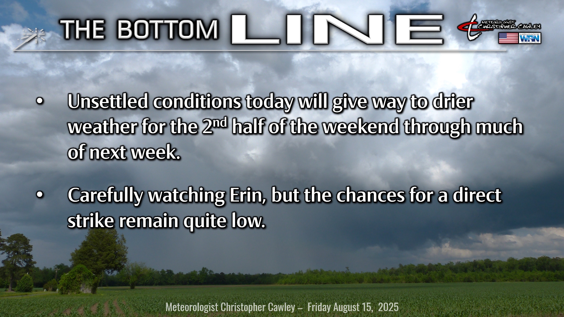
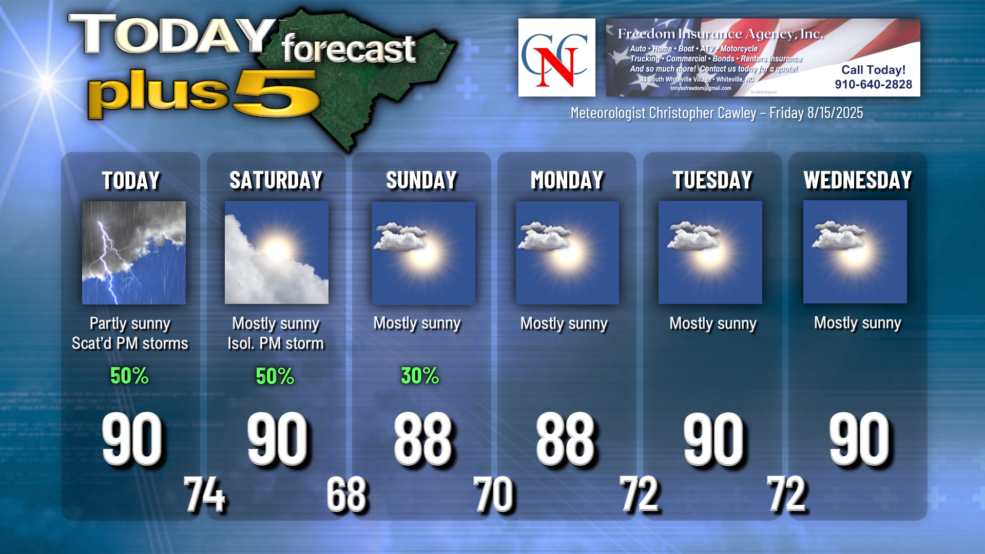
We’ve been in such a persistent pattern of sunshine and afternoon rain for what seems like days and days now. That’s going to be the case once again today, but I believe that our rain coverage will be a bit less… more “hit or miss” showers and thunderstorms. That being said, any storm that develops could produce intense rainfall and nearly continuous lightning. It’s going to be hot and humid today with highs around 90 but heat index values over 100.
Winds become northerly tonight behind a “cold front” (if you want to call it that). The boundary dissolves on Saturday, and while we will see an abundance of sunshine on Saturday, I cannot rule out an isolated shower or thunderstorm in the afternoon. Another push of dry air arrives Saturday night with a rather significant drop in our humidity levels.
Sunday will be a gorgeous day with abundant sunshine and near-zero rain chances. Light northerly winds also persist into Monday leaving us with dry skies and near-normal temperatures. The southerly flow returns Monday night into Tuesday leading to higher humidity… but mainly dry conditions should persist for most of next week.
Tropics: Tropical Storm Erin continues a west-northwest track in the central Atlantic ocean.
View the latest National Hurricane Center graphics HERE. Remember, the only OFFICIAL FORECAST you will find is from the National Hurricane Center.
The official NHC projection has her continuing a general west-northwest movement until getting just north of Puerto Rico, and then taking a northwest to north-northwest turn at that point. She is expected to become a major hurricane, at least category 3, quite possibly cat 4.
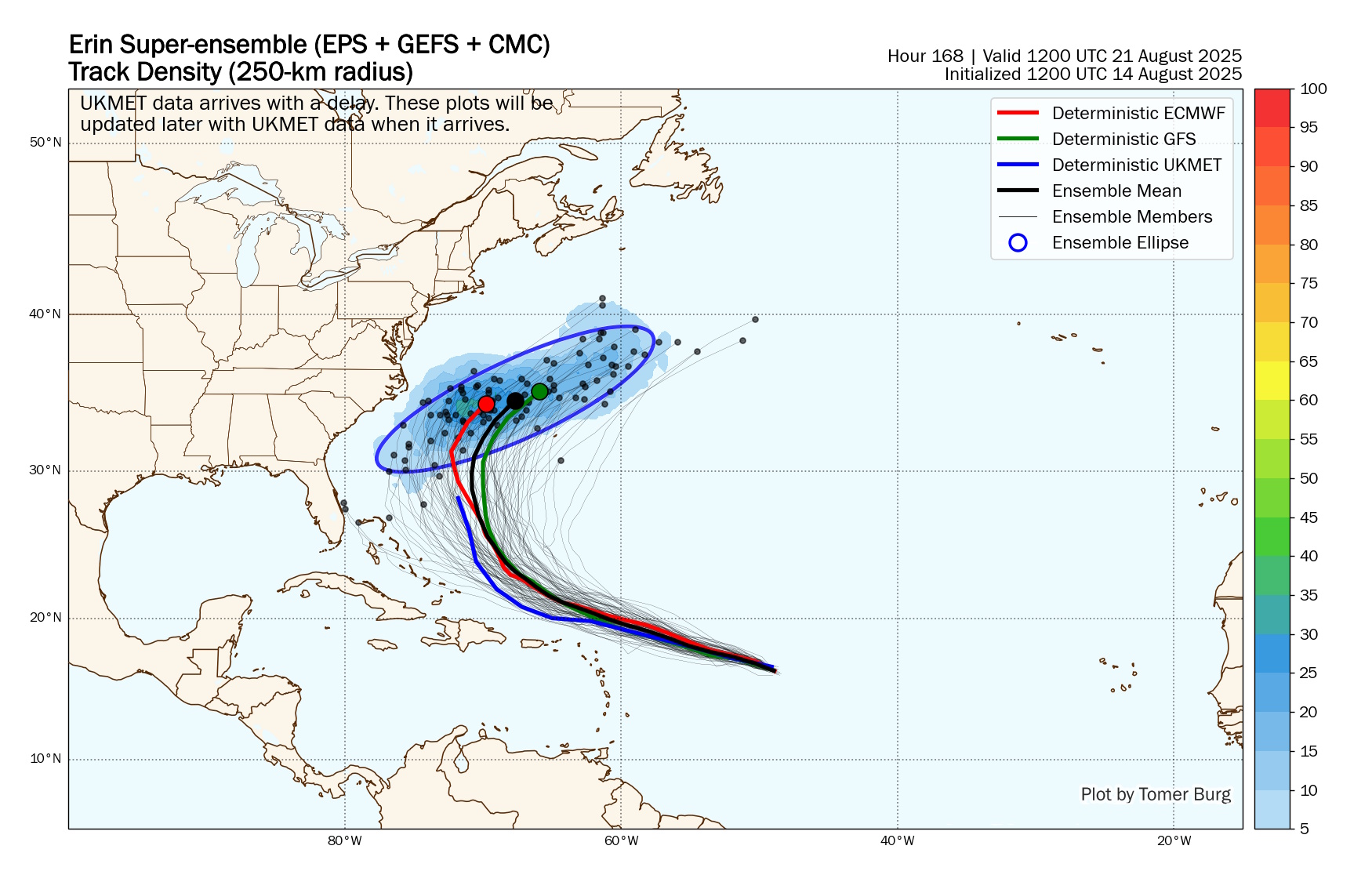
As I expected, modeling has shifted back away from the coast and is really clustering together quite nicely. I’m even more confident than I had been on a safely out-to-sea track for Erin.
There are scientific reasons why a northerly curve and a northerly track makes sense with such a strong hurricane, including the position of a high pressure center over the central Atlantic and the Coriolis “force” (effect). Coriolis causes moving objects (like storms) to deflect to the right in the northern hemisphere. A strong cat-3 (or higher) Erin, by laws of physics and the location of the high pressure cell to the east-northeast, will tend to make a “right” turn and follow the western edge of the high. Some of the modeling wanted to hint that the high would be stronger, or perhaps retrograde westward just a bit, thereby pushing Erin closer to the shore, and while that is certainly not out of the realm of possibilities, it’s becoming less and less likely with each passing day.
Another factor at play here is an area of high pressure over the southern U.S. This high will act as a bit of a “roadblock,” preventing Erin from advancing too close to the coast. The “gap” between these two highs is the path for Erin to take. If this high wasn’t in place, then yeah, I’d be worried about Erin riding up the east coast from Florida to Virginia like a cat-3 Nor’easter. But, folks, it’s more likely that the Atlanta Braves win the World Series this year (and that ain’t happening).
Let me reiterate: Erin is highly likely to stay comfortably and safely offshore. The ONLY impacts to the Carolinas are likely to be increased waves and deadly rip currents all next week.
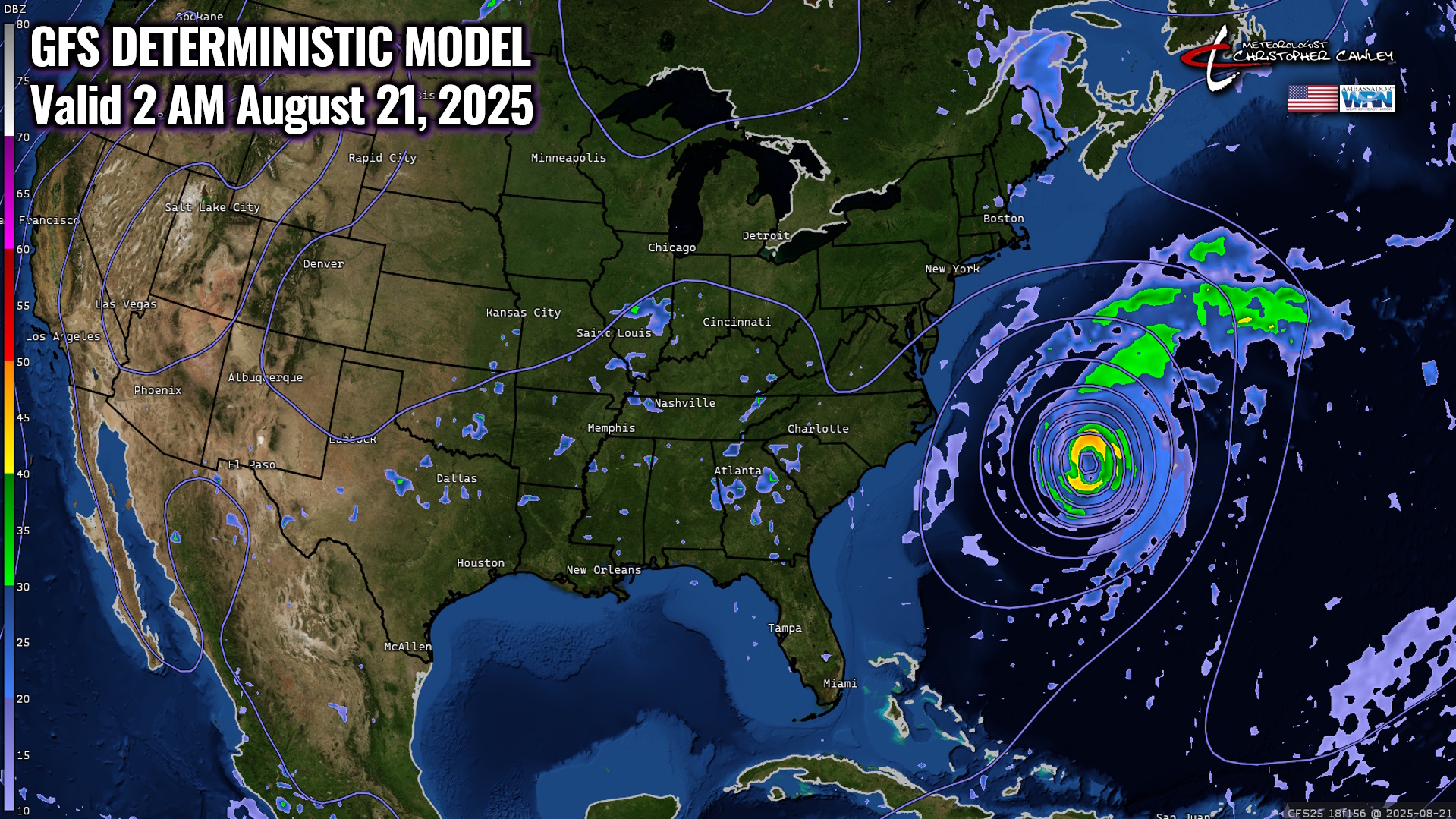
Here are the latest spaghetti plots, and below that is the latest GFS run (deterministic) for hour #156 (which is 6+ days from now). Remember, models are just models and are NOT an official forecast.
Relax, friends. Trust your local degreed, trained, experienced meteorologists… we’ll let you know if there’s reason to worry.
Here is your Freedom Insurance Today-plus-Five Forecast:
–Meteorologist Christopher Cawley