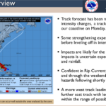
1:15 p.m. Sunday
Columbus County is under a tropical storm warning due to the approach of Isaias.
The storm is expected to make landfall Monday in South Carolina, and early forecasts have the center passing over Lake Waccamaw sometime in the early morning hours of Tuesday. The storm was downgraded to a tropical storm from a hurricane Sunday, but additional strengthening is possible before landfall.
In a briefing Sunday afternoon, the NWS upgraded the possibility of tornados in the area. Due to timing of the anticipated shift toward the northeast for Isaias, Columbus county will have an enhanced risk of tornados from Monday afternoon through Tuesday morning, especially in the overnight hours.
Rainfall between four and six inches is likely in some areas, with higher amounts possible, according to the National Weather Service.
Some flooding may occur in Fair Bluff and along the Lumber River during the storm, and downstream flooding of the Waccamaw River is highly dependent on rainfall amounts and the track of the storm.
Columbus County has not released information on emergency shelters, but persons in areas prone to flooding are urged to evacuate inland. Shelters will be strictly limited due to the pandemic.
Hal Lowder of the City of Whiteville said city officials are closely monitoring the storm, and working with Columbus Regional Healthcare on response.
Columbus County News will be providing up to the minute local coverage throughout the storm. Meteorologist Christopher Cawley is tracking the storm for z2j.c7e.myftpupload.com, and his updates will be shared as they become available. You can email your closings and delays to news@ccnews2020.com.


