Good evening, Meteorologist Christopher Cawley here with tonight’s weather update.
Not a whole lot to talk about… get outside and try to see the aurora before midnight.
Clear skies and chilly temps tonight as we’ll drop well into the 40s by sunrise Friday. Strong high pressure in firm control keeps bright blue sunny skies in place Friday through the weekend. As the high pushes east, a southerly flow sets up and our temperatures warm into the lower 80s by Sunday and Monday.
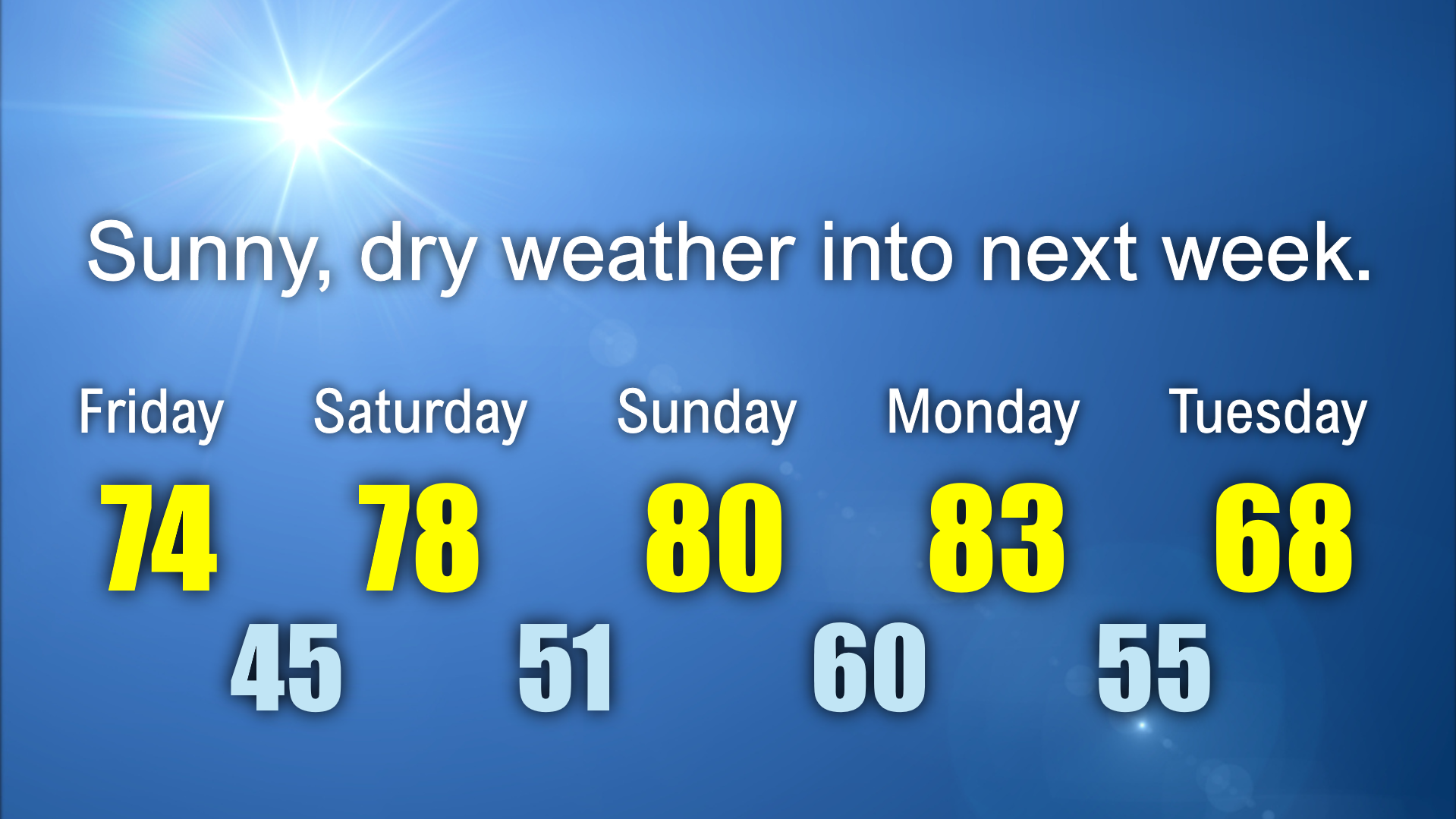
A strong cold front moves through late Monday. This may bring some cloudiness but with very little moisture to work with, the frontal passage will have very little fanfare. Tuesday and Wednesday next week will be much cooler with highs in the upper 60s.
Rumor Killer. No… there’s no “Nadine” out there in the ocean. People on social media are sharing some posts showing a new storm in the Gulf, taking an identical track to Helene, coming up for next week. This is not true. Milton continues to push east, losing tropical characteristics, and there’s nothing brewing in the Gulf or off the east coast. Please don’t share this “fake news” being shared on social media. If there’s anything about which to be concerned, you’ll find out about it here.
Take care, and thanks for reading!