Greetings and welcome to the CCN Daily Weather Update for Wednesday January 29, 2025.
This weather update is brought to you by our friends at Freedom Insurance. So you went to one of our local car lots and got yourself a sweet new sportscar… you’ll want to make sure it is top-tier insured. Who better to call in Whiteville than Freedom Insurance, who will make sure that pretty ride is well-covered from bumper to bumper. Call them today at 910-640-2828.
Our climate statistics for Tuesday, January 28 at my weather station in Whiteville shows that we had a high temperature of 60.5°F at 3:52 PM and a low of 43.2°F at 7:49 AM. There was no precipitation today. You can check out the conditions in Whiteville in real-time by clicking on this link — https://www.wunderground.com/dashboard/pws/KNCWHITE8
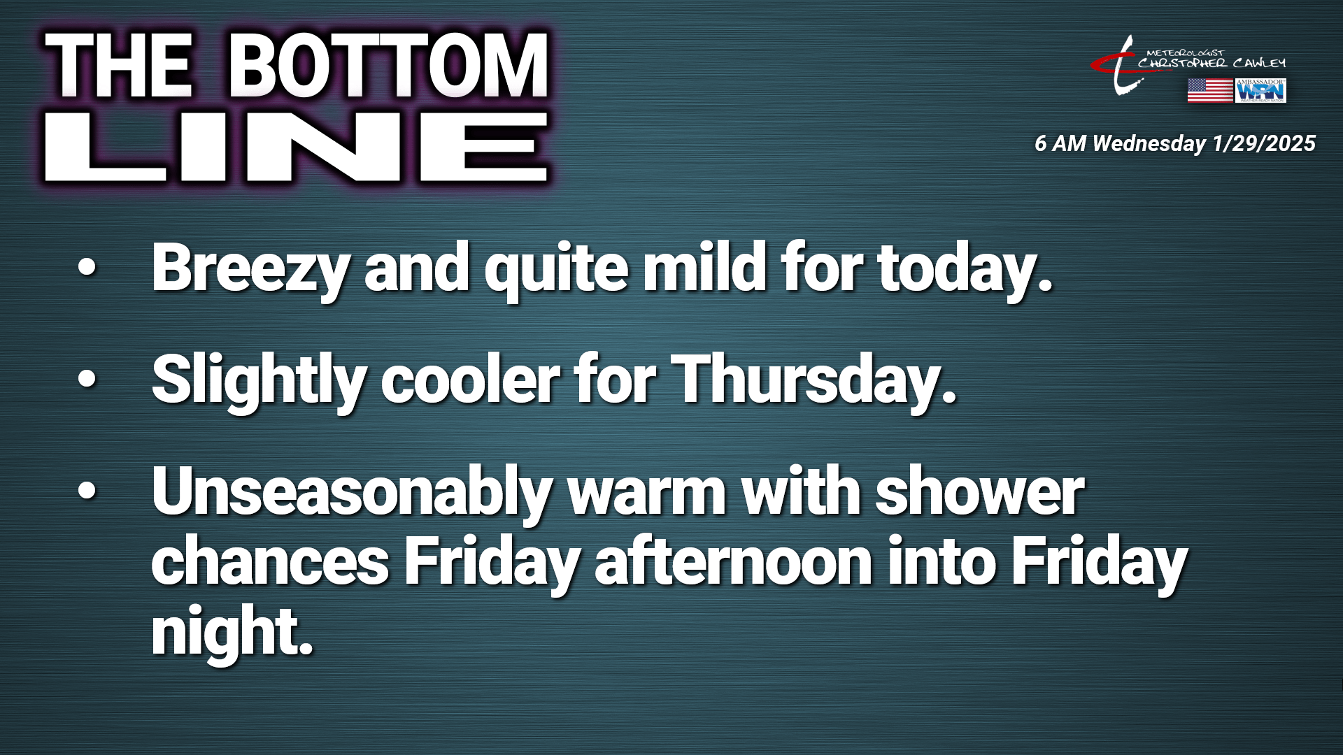
The Bottom Line
One week ago today we awoke to a fresh snowfall ranging from 6 to as much as 9 inches across the county. What a difference a week makes as today we’ll see sunny skies and a high near 70.
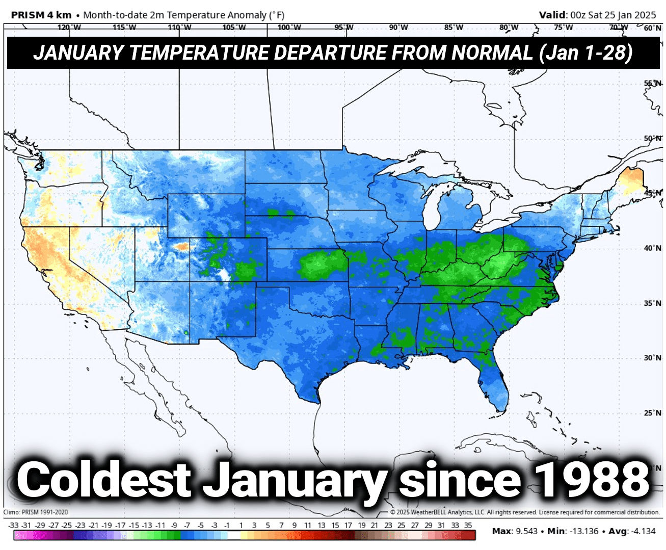
I was doing a little research, and this month has been the coldest January in the lower 48 since 1988.
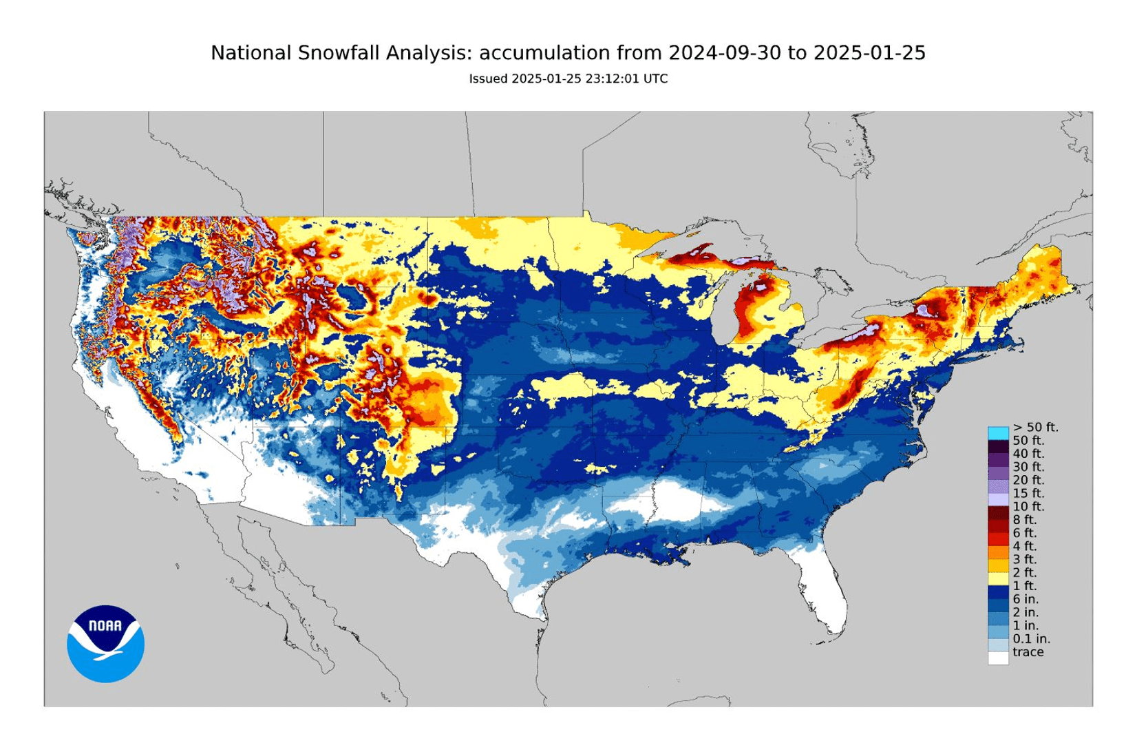
Oh, and speaking of snow, this chart shows the total accumulated snowfall over the lower 48 states since the end of September. Every single state in the lower 48 has had accumulated snowfall. Actually, correction, ALL 50 states have had accumulated snowfall, even the highest peaks of the Hawaiian island chain. What a winter this has been! And it’s really only halfway over!
Ok, now for some more relevant details for good ol’ Columbus County, North Carolina.
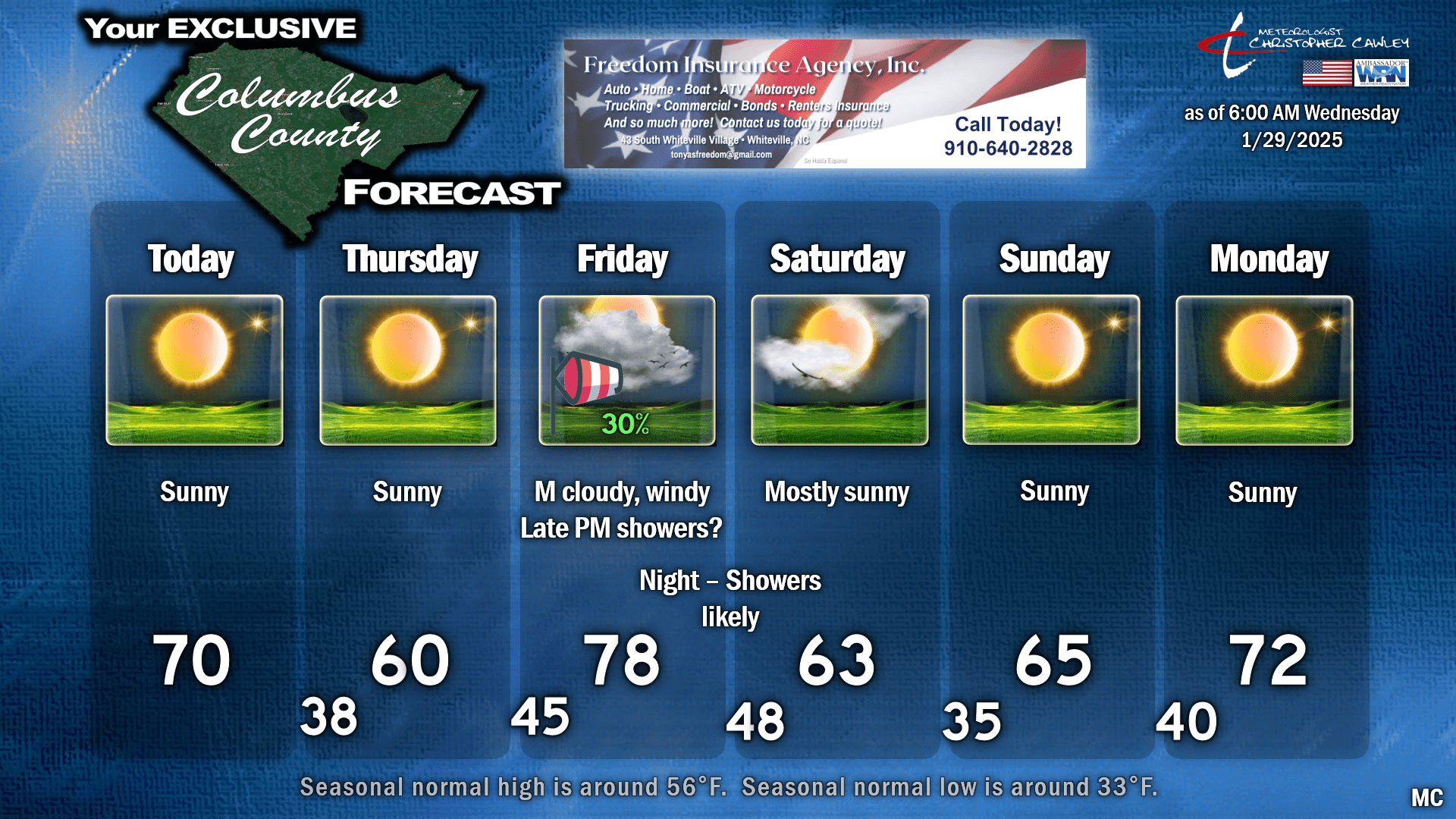
Today is going to be fantabulous, yes that’s a word, because I said so. Bright blue sunny skies, highs around 70. It’ll be a little breezy at times, and since the humidity will be low it might be best to avoid any outdoor burning… but gosh it’s going to be a nice day. Try to get out and enjoy some of it.
A backdoor cold front drops south over the area tonight while we sleep. There’ll be no noticeable “weather” with the frontal passage, but highs on Thursday will be cooler, generally around 60.
Then things start to get active once again. A “bowling ball” low that I’ve mentioned over the past few days will gradually move eastward, entering the Great Plains on Thursday and then lifting northeast to the Great Lakes on Friday. This will drag a rather strong cold front across the county late Friday afternoon or Friday night.
As this all plays out, a very strong low-level jet stream becomes established over the eastern US Thursday night. This will bring REALLY WARM temperatures to the area on Friday… maybe pushing 80°F (!! but I’m not brave enough to put it on the graphic). This will likely also bring strong winds down to the surface on Friday, especially from late morning until the frontal passage. GFS and Euro both suggest 30-40+ mph winds in here Friday afternoon.
A line of convection is nearly certain with the frontal passage. There are some timing issues in the modeling; the GFS paints a line of showers and maybe a rumble of thunder (?!) rolling through during the evening hours on Friday, while the Euro is signaling an overnight passage Friday night/early Saturday.
The GFS hints at some meager surface-based instability Friday evening just ahead of the frontal passage. The shear values are also looking somewhat robust. Ultimately if the GFS depiction proves accurate, we’ll see “gusty showers” roll through Friday evening into the early overnight… and maaaaybe a rumble of thunder. Euro says no, just a period of rainfall during the early overnight hours. It’s really too soon to micromanage those specifics.
Both models show a quick frontal passage so while the rain may come down pretty hard at times, it’ll be a quick hit.
Quieter weather moves in for Saturday. Most of the colder air behind the front will be north of the area; I believe we’ll be solidly in the 60s over the weekend, rising back into the 70s next week.
I won’t say that spring has sprung, as long range guidance hints at some colder air pushing down from Canada toward the middle of February. Right now it doesn’t look anything close to the magnitude of what we saw earlier this month, but don’t put away the jackets quite yet.
Here’s your Freedom Insurance Today-plus-Five forecast for Columbus County.
That’s going to wrap up our blog for today, friends. Open up the windows, and try to get outside today. It’ll do ya good. Thanks for reading, and as always, take care.
~Meteorologist Christopher Cawley