Hello friends and neighbors, and good day to you! Welcome to the CCN Weather Update for Saturday May 24, 2025.
This weather update is sponsored by Freedom Insurance of Whiteville. When severe weather strikes, with Freedom Insurance you will always be prepared. For home, car, boat, or whatever you need, Freedom can provide customized coverage to keep you and your family safe. Contact Freedom today at 910-640-2828!
STATISTICS for Friday 5/23/2025
High: 86.0°F at 3:29 PM (Normal 82)
Low: 61.5°F at 6:39 AM (Normal 60)
Precip: 0.00 in
Precip – Month: 6.37 in
View real-time data from the weather station at College Street Weather Station.
Here’s today’s Bottom Line
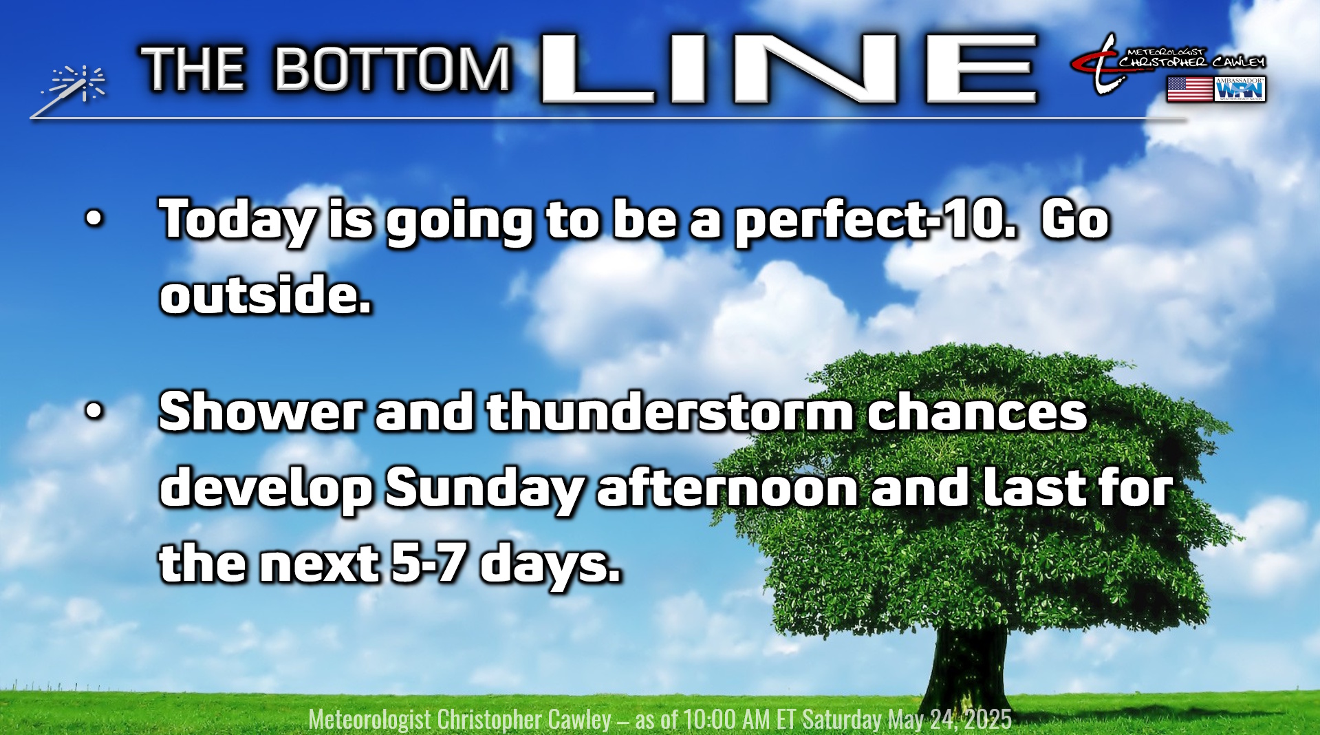
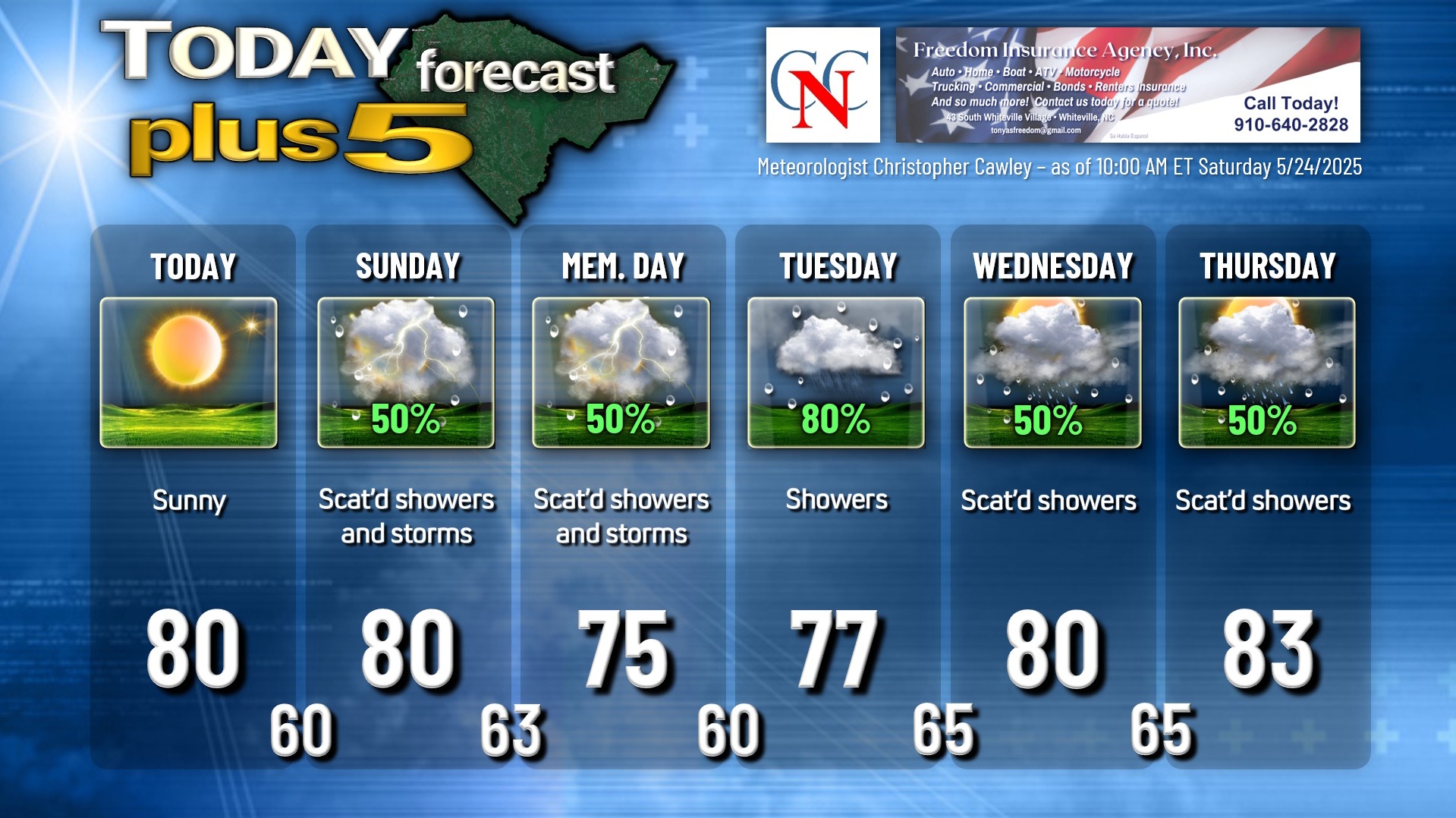
Today is going to be about as perfect as you can get for Memorial Day weekend weather. I strongly urge you to get outside as much as you can this afternoon… this is going to be the last guaranteed rain-free day for at least the next week, if not longer. Comfortable temps, low humidity, sun-splashed skies. It really can’t get much better.
Unless you’re a fan of rainy weather. If you are, then you’re going to love the remainder of this report.
A frontal boundary will lift north over the area Sunday afternoon. This will be the lifting mechanism needed for the development of scattered showers and thunderstorms. I don’t think we’re looking at a washout, but if you have any plans tomorrow afternoon, carry an umbrella and be ready for changeable weather conditions.
This front gets kind of hung up over the area, and a series of low pressure waves will ride along the front for Memorial Day and Tuesday, before a “cold” front slowly pushes across the area on Wednesday.
Modeling is hinting at an area of low pressure developing offshore in the Wednesday/Thursday timeframe which could increase the rain potential here … I’m not quite sold on that yet but with a cold front right along the coast, that certainly would make sense for an area of low to spin up along the front (NOT tropical in nature).
No matter how you slice-and-dice it, we’re looking at off-and-on rainy conditions all next week. Model blend rainfall totals through 8 AM next Sunday (June 1st) averages about 2-3 inches of rain over the county. That, of course, would be highly dependent upon where showers and thunderstorms set up.
So I can’t stress it enough. Go outside today. Do it. Go!
TROPICAL WEATHER FORECASTS are returning as of June 1st, the official start of hurricane season.
Here is your Freedom Insurance Today-plus-Five Forecast:
That’s going to do it for today’s report. As always, thank you for reading and for supporting Columbus County News. Have a great day!
–Meteorologist Christopher Cawley