Hello friends and neighbors, and good day to you! Welcome to the CCN Weather Update for Memorial Day, Monday May 26, 2025.
This weather update is sponsored by Freedom Insurance of Whiteville. When severe weather strikes, with Freedom Insurance you will always be prepared. For home, car, boat, or whatever you need, Freedom can provide customized coverage to keep you and your family safe. Contact Freedom today at 910-640-2828!
STATISTICS for Sunday 5/25/2025
High: 80.0°F at 4:03 PM (Normal 82)
Low: 66.0°F at 5:29 AM (Normal 60)
Precip: Trace
Precip – Month: 6.37 in
View real-time data from the weather station at College Street Weather Station.
Here’s today’s Bottom Line

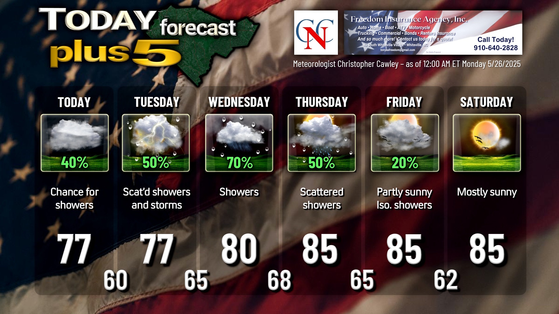
Lots of unsettled weather on tap this week with lots of clouds and rainy periods just about all week long.
So what’s going on? We have a stationary frontal boundary snaking across central South Carolina. A few weak waves of low pressure will move along this front today through tomorrow, bringing chances for showers and thunderstorms. It’s impossible to predict just where these showers/storms will set up, and it’s possible that some areas of the county get no rain whatsoever. I wouldn’t hedge any bets on it though, so carry the umbrella with you for whatever plans you have today, and back to work tomorrow.
The front starts to push northward as a warm front later Tuesday evening, with another wave of low pressure hitching a ride along it. As this moves over the area, you can expect more widespread periods of rain for Tuesday night through Wednesday night. This will likely be the most concentrated rainfall for the week.
Modeling isn’t handling all of this very well, so I’m kind of mentally “blending” all of the various solutions to come up with my forecast for, again, PERIODS of rain late Tuesday night through Wednesday evening.
A “conditionally unstable” air mass becomes established Wednesday night through Thursday as we are in a warm sector. There will be an abundance of deep moisture over the area, so showers and thunderstorms are a pretty good bet for Thursday, although we may see some breaks of sunshine as well. A cold front moves through the area late Thursday night or early Friday. While this will also be a forcing mechanism for showers/storms, this will cut off the Gulf moisture connection, so shower chances drop considerably for Friday, and we finally achieve dry conditions by Saturday. There’s a “bust” potential by the end of the week because the GFS model seems to insist on an upper-level low moving across the Ohio Valley which could spin another front across our area by Saturday… I’m not sure I buy into that solution, but we’ll see how that all plays out.
In summary — the highest chances for rain come late Tuesday through Wednesday into Wednesday evening. Occasional/scattered showers and storms today, Tuesday, and Thursday. Model blends are shading a good 2-3 inches of rain across the county for a total through 8 AM Saturday.
TROPICAL WEATHER FORECASTS are returning Sunday June 1st, the official start of hurricane season.
Here is your Freedom Insurance Today-plus-Five Forecast:
That’s going to do it for today’s report. As always, thank you for reading and for supporting Columbus County News. Have a great day!
–Meteorologist Christopher Cawley