
Hello friends and neighbors, and good day to you! Welcome to the CCN Weather Update for Monday June 2, 2025.
This weather update is sponsored by Freedom Insurance of Whiteville. When severe weather strikes, with Freedom Insurance you will always be prepared. For home, car, boat, or whatever you need, Freedom can provide customized coverage to keep you and your family safe. Contact Freedom today at 910-640-2828!
STATISTICS for Sunday 6/ 1/2025
High: 84.0°F at 3:55 PM (Normal 84)
Low: 61.3°F at 6:19 AM (Normal 62)
Precip: 1.12 in
Precip – Month: 1.12 in
Final total rainfall for May: 7.91 inches
View real-time data from the weather station at College Street Weather Station.
Here’s today’s Bottom Line:
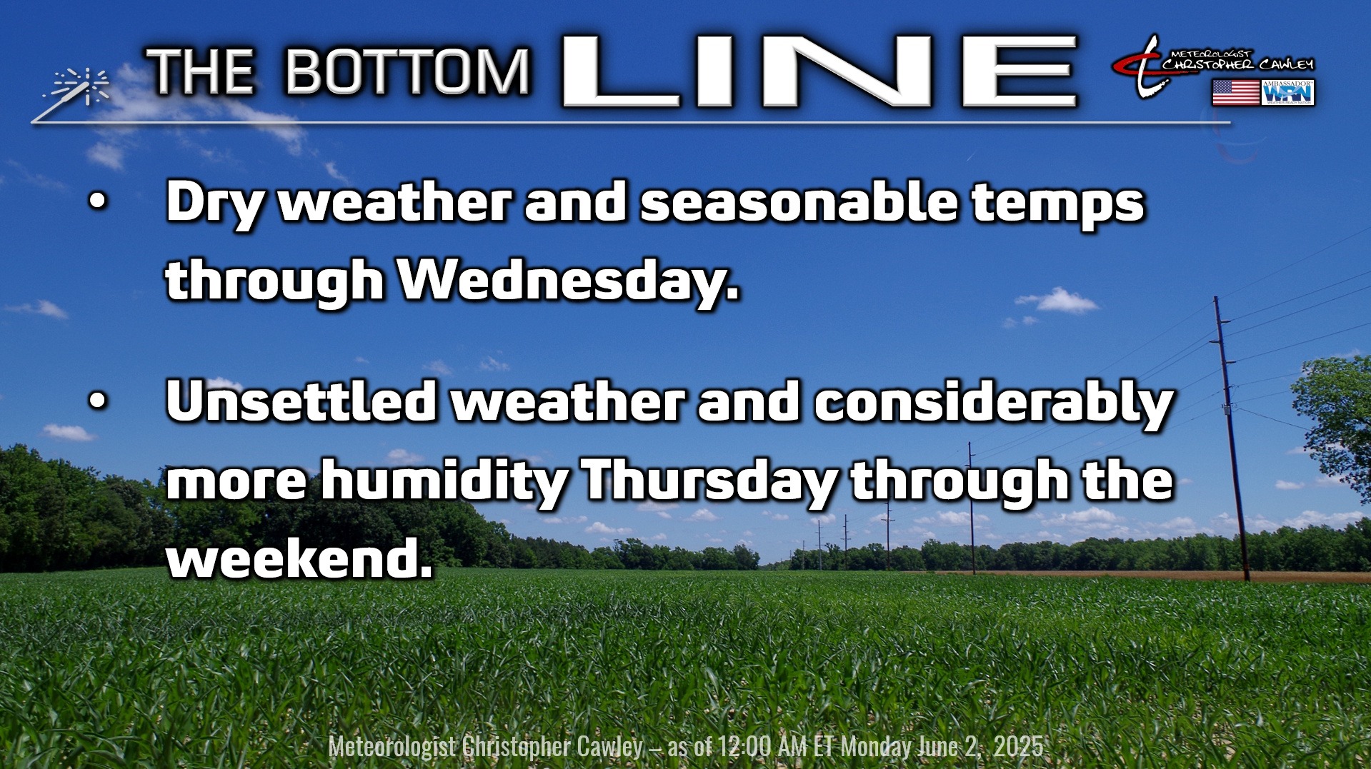
A cold front passage was responsible for the severe thunderstorms that rocked most of the county last evening, dropping pea to quarter size hail over the Chadbourn to Whiteville area. We also picked up a considerable amount of rain from the storm.
That’ll be the last of the rainfall now for several days as high pressure builds in from the north. Humidity levels will be kept in check for today and pretty much all of tomorrow, before creeping back as we move into the second half of the work week.
Surface and mid-level high pressure shifts offshore by Wednesday into Thursday. This allows a southerly flow of much more humid air to push into the region. A surface low pressure center is shown by modeling to develop off the Florida east coast later on Wednesday and then drift slowly northeastward toward the Carolinas on Thursday. This will bring a chance for showers and thunderstorms back into the area on Thursday, mainly during the afternoon and evening.
This surface low should move north of our area by Friday and then get kind of “absorbed” in the general southwest wind flow. Guidance suggests a dying cold front moves into the area by Saturday bringing increased chances for showers and storms. This front waffles back and forth over our area as it dissipates on Sunday.
True summertime heat and humidity will be in place Thursday through the weekend.
TROPICS: The 2025 Hurricane Season has begun! June typically sees tropical development across the Gulf and off the southeast coast of the US, as cold fronts stall and dissipate offshore. Systems that form in the month of June are usually rather weak and more subtropical in nature.
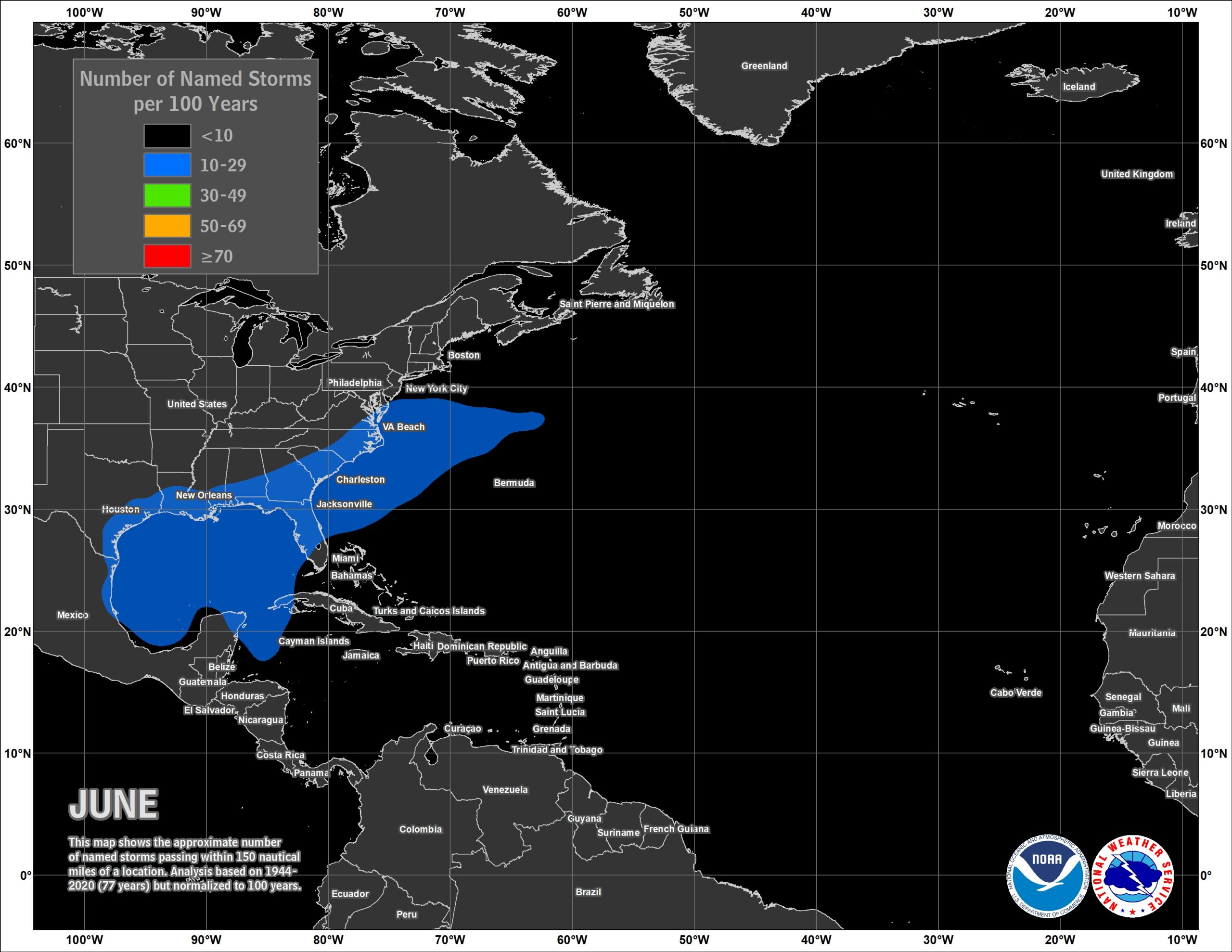
OUTLOOK: No tropical systems are anticipated over the next 7 days. An area of low pressure is expected to develop off the east coast of Florida and lift north along the coast, before dissipating into the general wind flow. Sometimes these kinds of low pressure areas can take on subtropical characteristics, but atmospheric conditions just aren’t favoring that at this time.
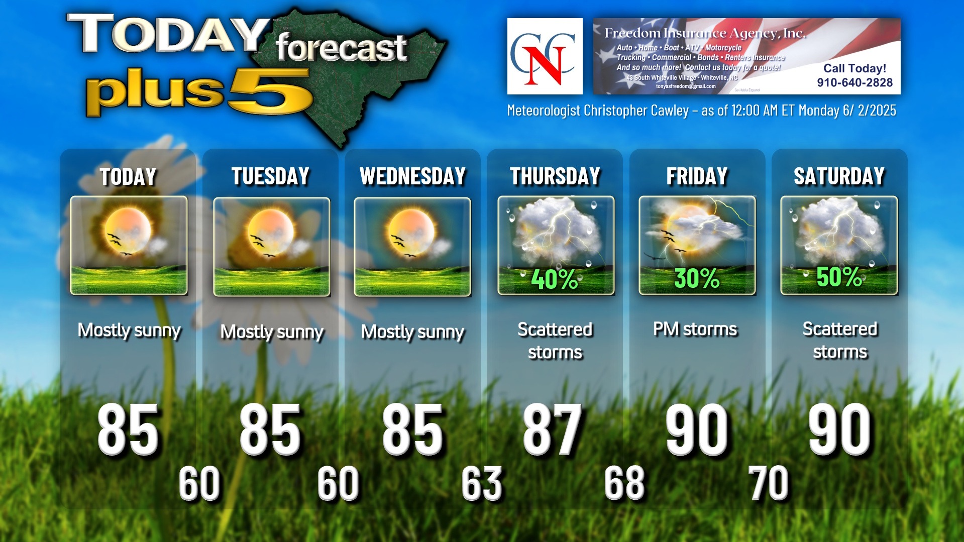
Here is your Freedom Insurance Today-plus-Five Forecast:
That’s going to do it for today’s report. As always, thank you for reading and for supporting Columbus County News. Have a great day!
–Meteorologist Christopher Cawley


