SPECIAL UPDATE – TROPICAL STORM CHANTAL – AS OF 5 PM SATURDAY
Good afternoon, here’s my latest update on Tropical Storm Chantal, including NWS observations and my own forecasting.
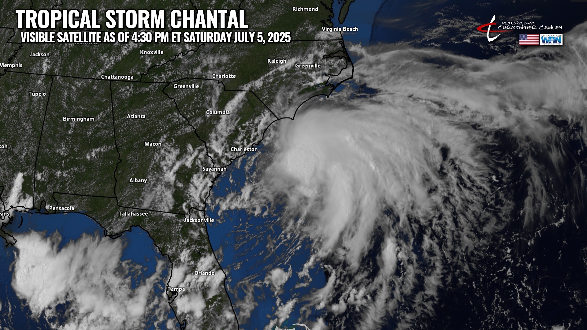
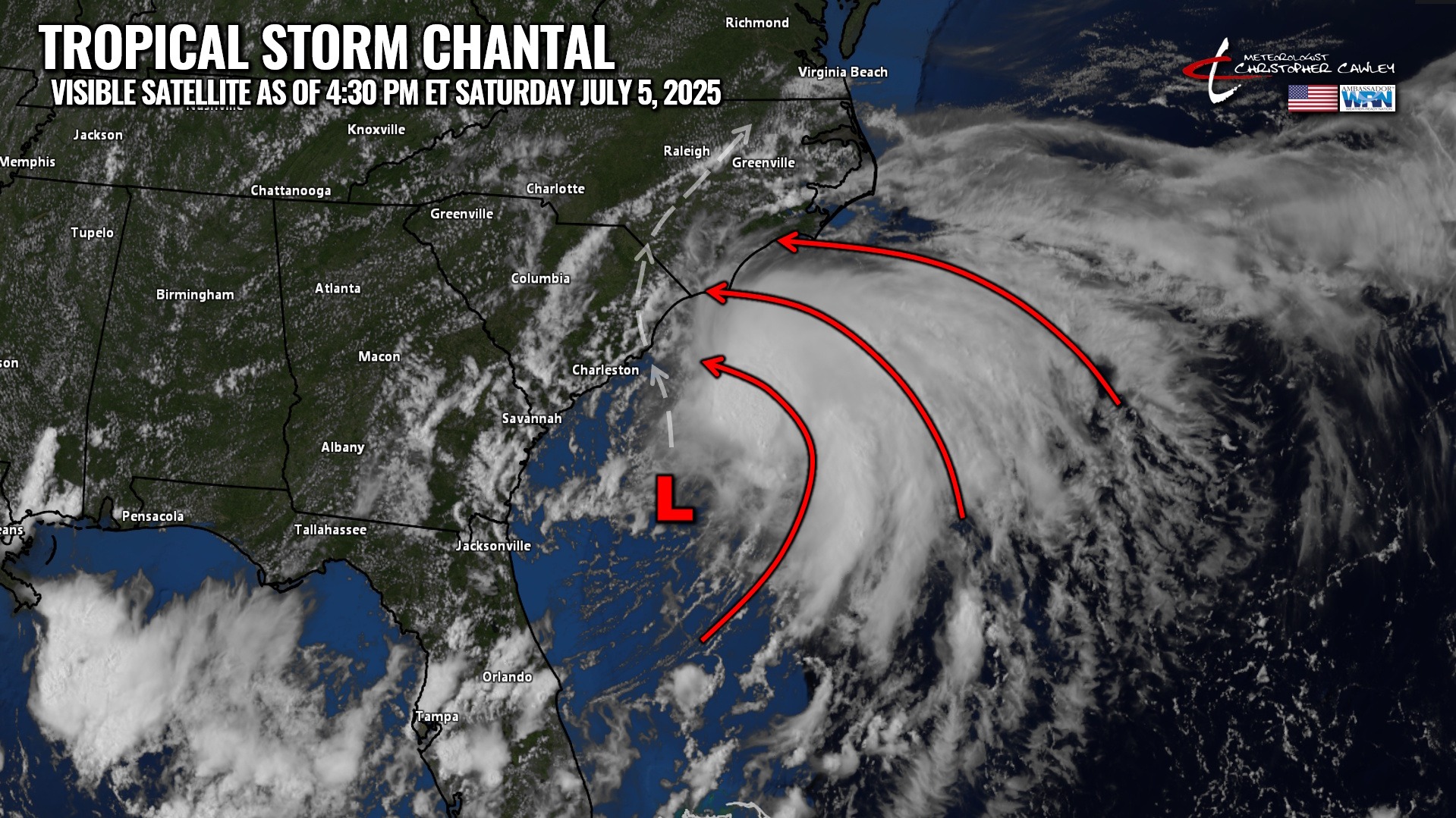
According to the National Hurricane Center, TS Chantal is located about 95 miles to the southeast of Charleston, SC, or about 165 miles to the south-southwest of Wilmington, NC. The storm has maximum sustained winds of 45 mph and is moving to the north at about 7 mph.
The storm is expected to make landfall somewhere in southern Georgetown County early Sunday morning.
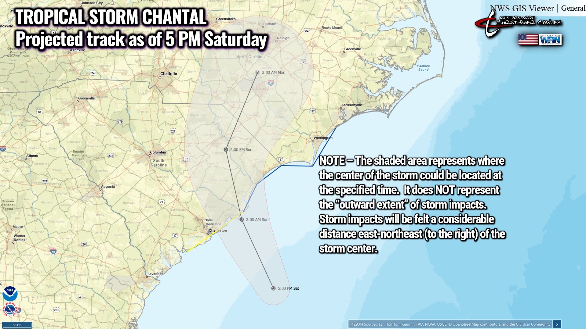
Most of the rain/wind from Chantal is displaced north and east of the center of low pressure. Most of the impacts from Chantal will, therefore, be generally east-northeast (or to the right) of the landfalling storm tonight through tomorrow morning.
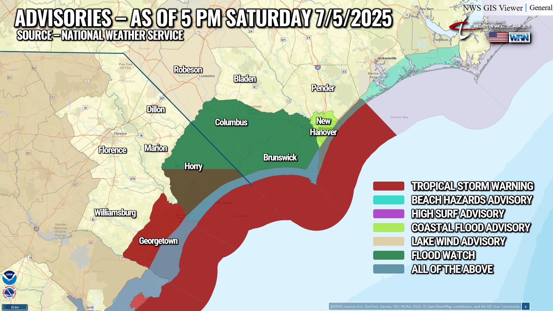
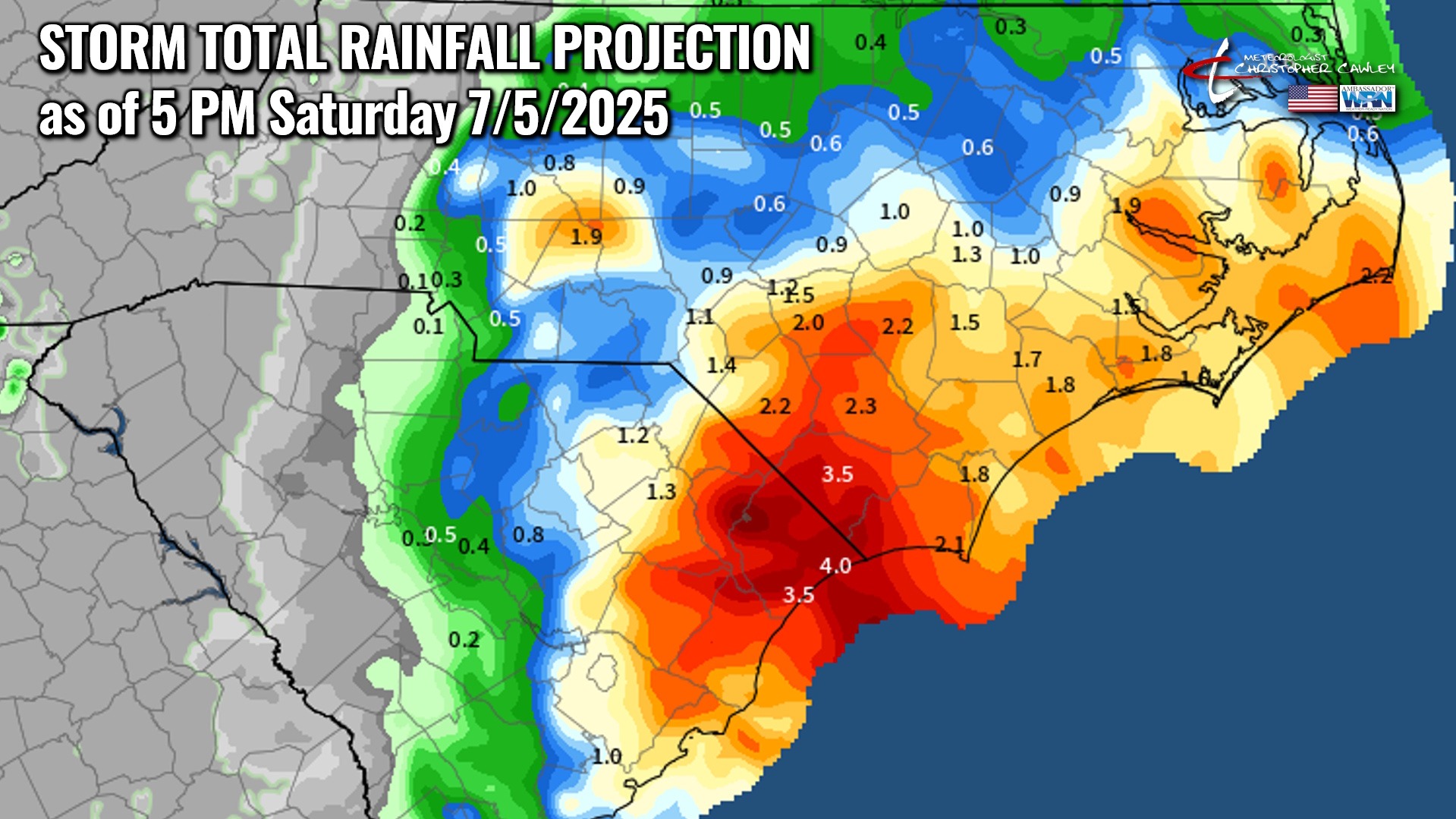
LOCAL IMPACTS — COLUMBUS COUNTY
Rain: Rainfall amounts of 3-4 inches can be expected; the NWS NDFD projection has the highest amounts along the state line. There will be considerable variability in the storm total rainfall amounts depending on when/where the rain bands come ashore. Some areas could receive relatively light rainfall while others receive much more.
Wind: Sustained winds of 15-25 mph with gusts 30-40 mph are possible late tonight through mid-afternoon Sunday. Wind conditions will improve through the afternoon on Sunday. Isolated to widely scattered power outages are possible due to tree limbs being blown down. Weaker/decaying trees may be knocked down in the stronger gusts.
Tornado: Threat is quite low… but not zero… as rain bands pinwheeling in off the ocean can start to ‘rotate’ a bit due to land friction. This could lead to isolated brief, weak spin-ups that are difficult to detect on radar and may have little to no advanced warning. The NWS Storm Prediction Center has our area under a MARGINAL RISK (level 1 out of 5) for tornado development on Sunday.
A FLOOD WATCH is up for Columbus County until Monday.
All-in-all this will be a “rain storm with a name” for Columbus County. It won’t be particularly memorable or eye-popping. I don’t expect a lot of widespread flooding to occur; however, flooding of poor-drainage and low-lying areas is probable late tonight through Sunday. Ponding of water on roads is almost a certainty.
Expect the “worst” of the storm conditions between roughly 3 AM and 12 PM on Sunday, with improving conditions during Sunday afternoon into Monday.
–Meteorologist Christopher Cawley