CCN Weather Update for Saturday July 26, 2025.
This weather update is sponsored by Freedom Insurance of Whiteville. No weather worries with Freedom Insurance. For home, car, boat, or whatever you need, Freedom can provide customized coverage to keep you and your family safe. Contact Freedom today at 910-640-2828!
The high temperature at my station for yesterday was 97.4°F. My forecast was 98°F so that’s a win.
View real-time data from the weather station at College Street Weather Station.
Here’s today’s Bottom Line
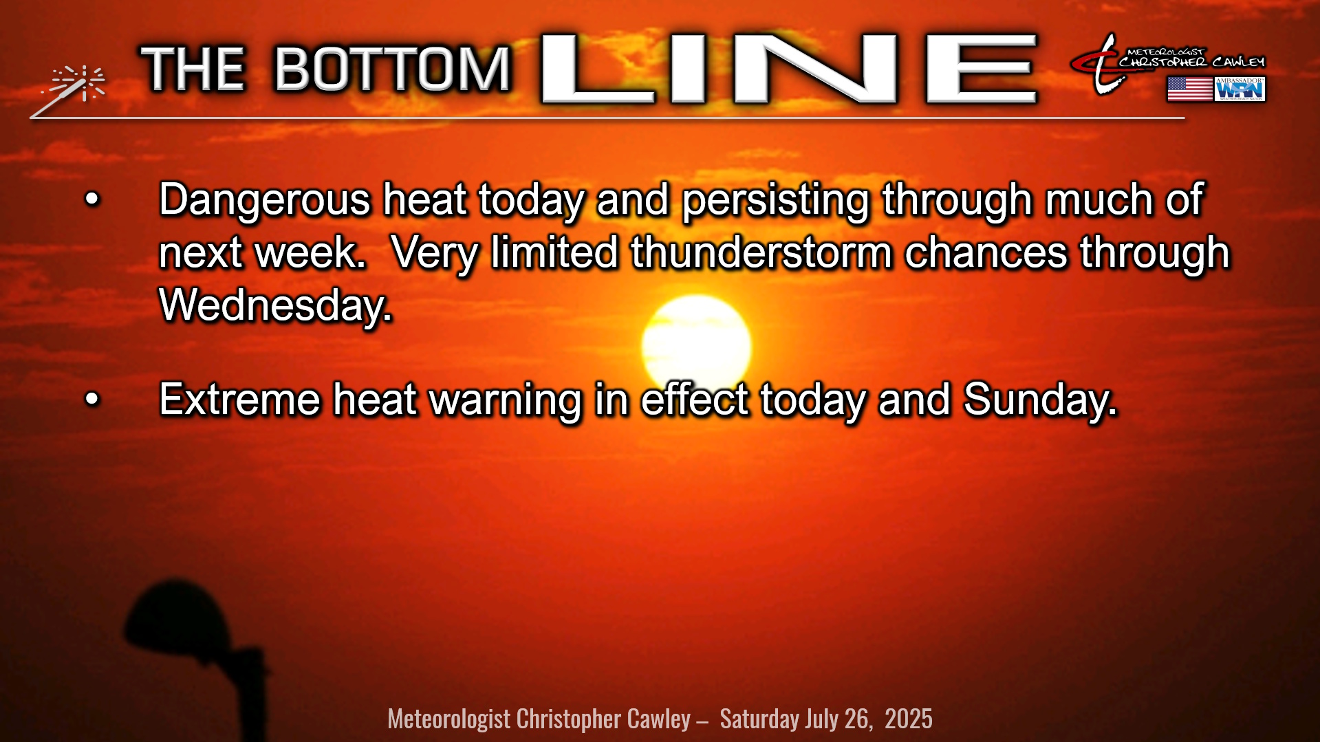
DANGEROUS, PROLONGED HEAT WAVE CONTINUES.
An unusually strong high-pressure ridge over the area will bring dry skies, unrelenting sunshine, blistering heat, and near-zero thunderstorm chances today through at least Monday. Isolated storm chances start to appear Tuesday and Wednesday. Isolated.
But the big story is the heat.
These temps are no joke, folks.
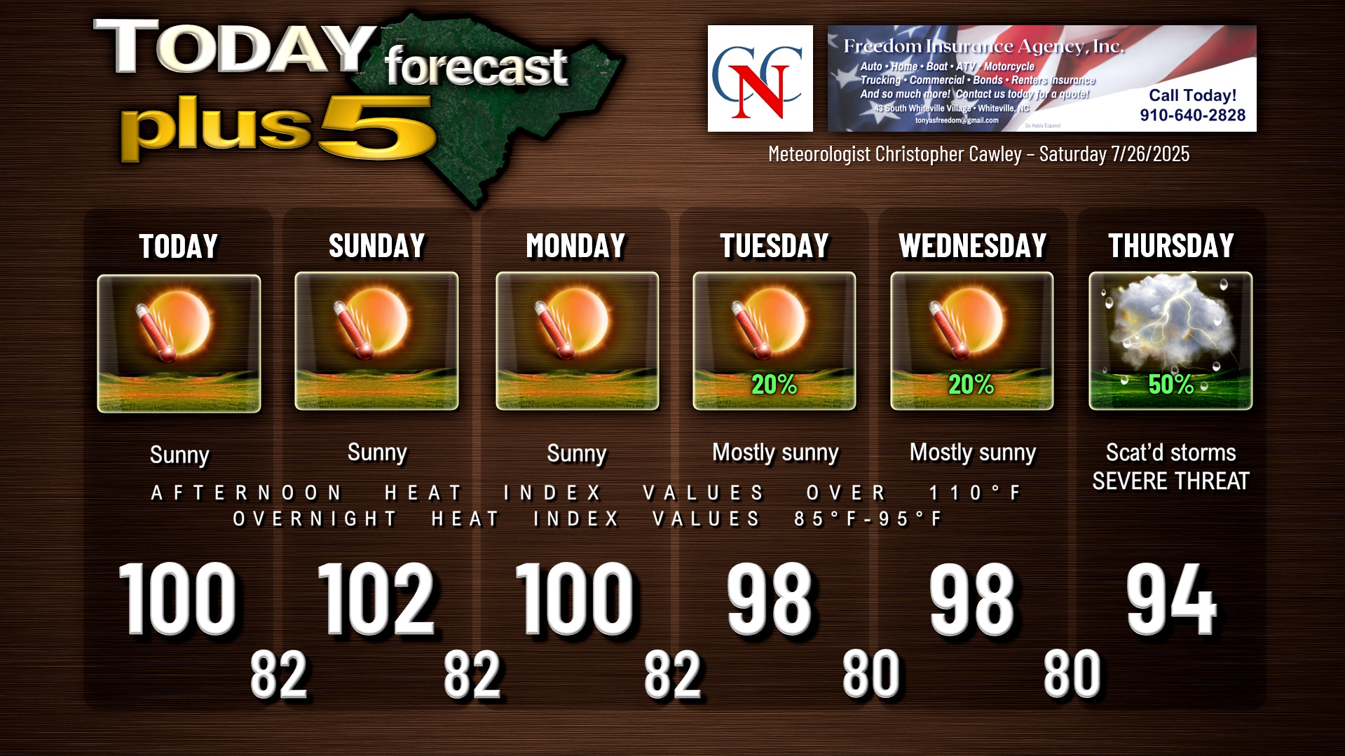
- Highs today and Sunday will be in the 100-104 range… Sunday will likely be the hottest of this heat wave.
- Highs Monday will be around 100.
- Highs Tuesday and Wednesday will be in the upper 90s.
Heat index values will be over 110°F… possibly even higher than 115°F. Overnight heat index values will average in the lower 90s.
It is becoming more likely that a strong cold front breaks down the high pressure ridge by Thursday. This allows for the development of thunderstorms. With day after day of unrelenting heat and building instability, there’s the potential that the heat wave comes to a crashing and rather dramatic conclusion on Thursday. Severe weather is almost a certainty given the potential strength of this front crashing into an equally strong high pressure ridge.
Hang in there: Long-range modeling shows our highs in the lower to middle 80s in the August 2-6 timeframe, with lows in the 60s!
Until then, it’s dang hot.
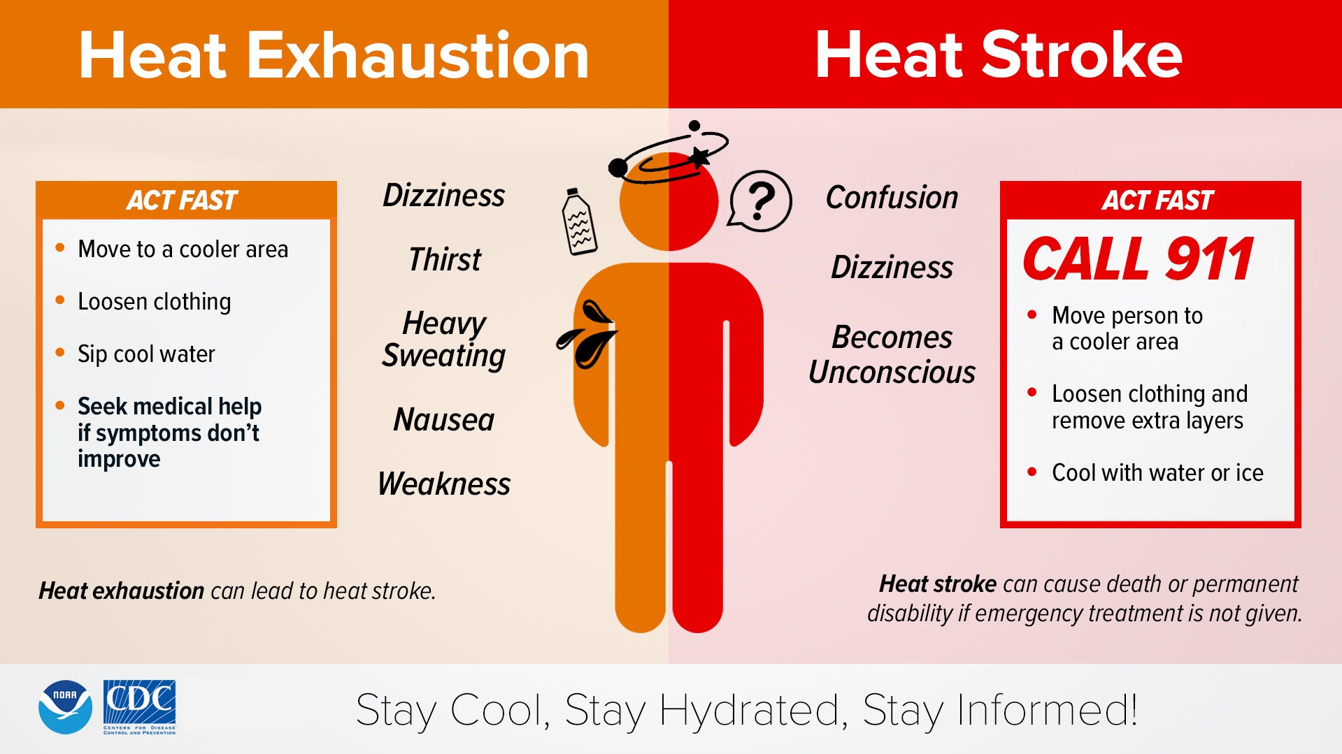
Please, please take precautions with the heat. It’s not a joke, like I said, and heat exposure is one of the top weather-related killers. Please take care of any outdoor activities early this morning or this evening, but again, heat index values will remain over 100°F deep into the evening hours… possibly even midnight.
Pay attention to symptoms of heat exhaustion and heat stroke.
Heat stroke is a medical emergency and requires a 911 call.
And for the love of everything that’s good in the world, please, please, please double… no… triple check the back seat. Vehicle interiors can heat up to 130-140+ within minutes. Please don’t have Jefferson write about a child or pet succumbing to the heat having been locked in a hot car.
The NWS has posted an extreme heat warning for both today and Sunday.
TROPICAL OUTLOOK: The disorganized low-pressure system will move into eastern Texas today. That will end that threat. Otherwise, there is nothing of interest in the tropics.
Here is your Freedom Insurance Today-plus-Five Forecast:
–Meteorologist Christopher Cawley