CCN Weather Update for Saturday August 23, 2025.
This weather update is sponsored by Freedom Insurance of Whiteville. No weather worries with Freedom Insurance. For home, car, boat, or whatever you need, Freedom can provide customized coverage to keep you and your family safe. Contact Freedom today at 910-640-2828!
Here’s today’s Bottom Line
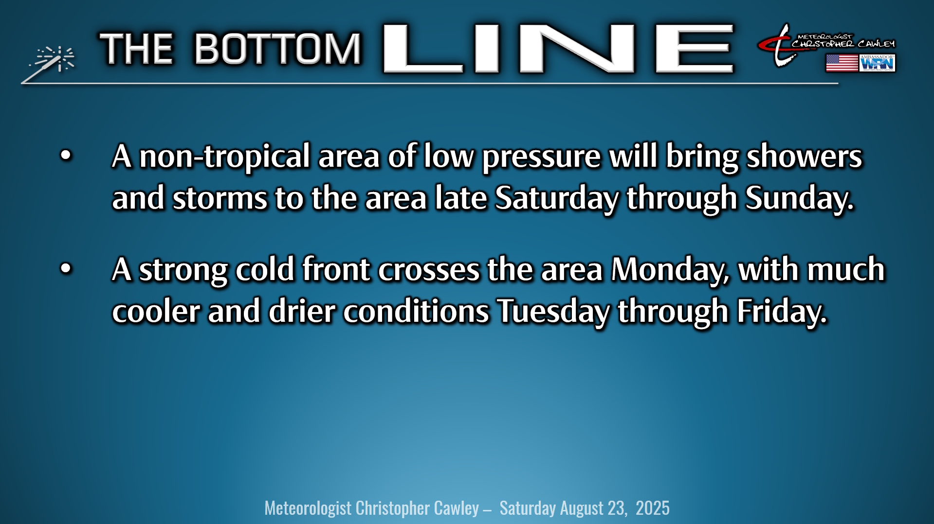
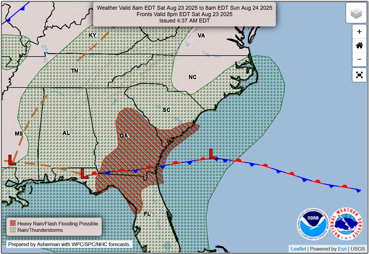
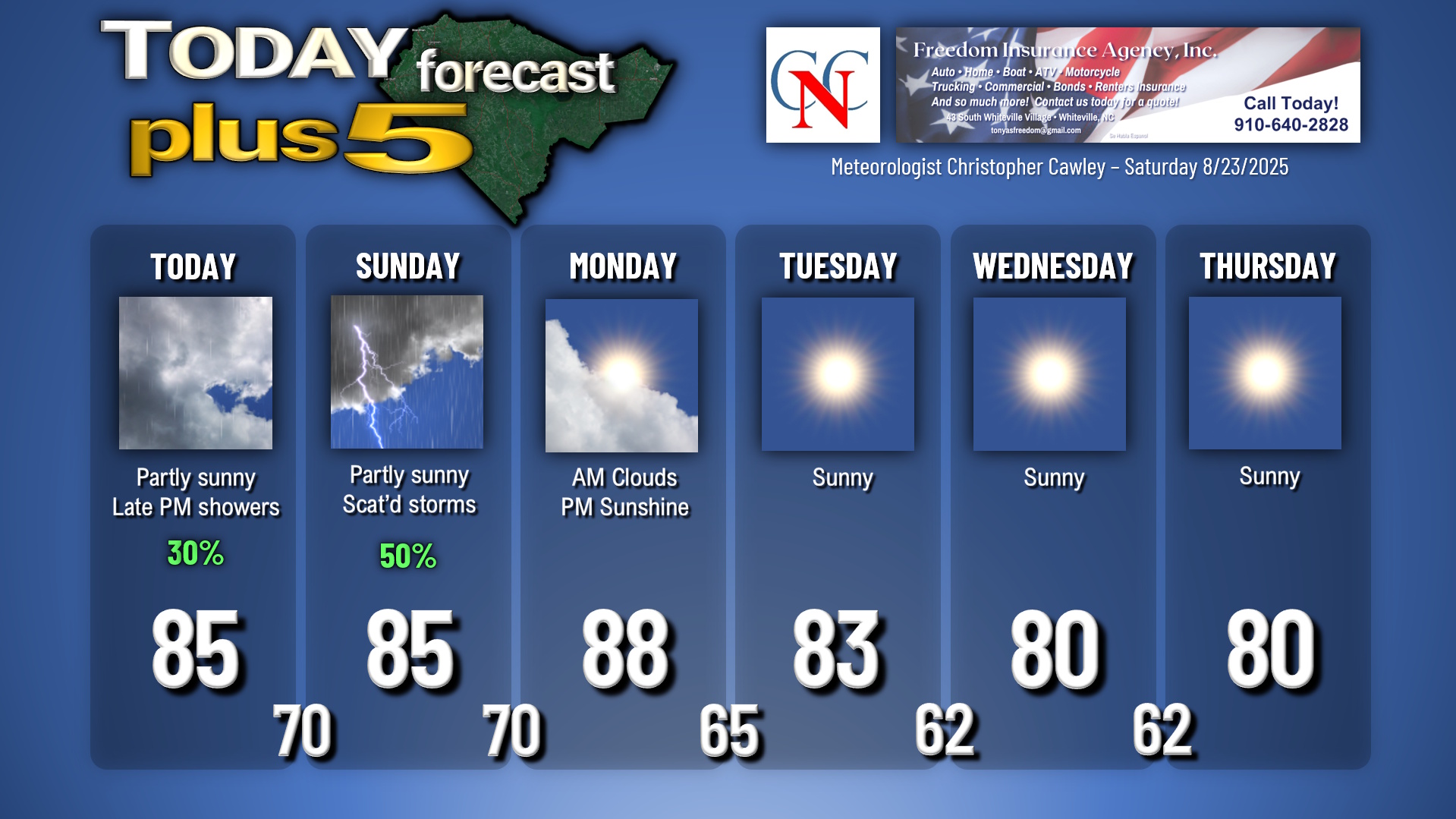
A non-tropical area of low pressure will lift along a frontal boundary this weekend. We’ll start off with a mix of sunshine and clouds today, trending mostly cloudy, with some showers developing later this afternoon. Showers and a chance for thunderstorms will be the rule tonight through Sunday as this low rides up the coast.
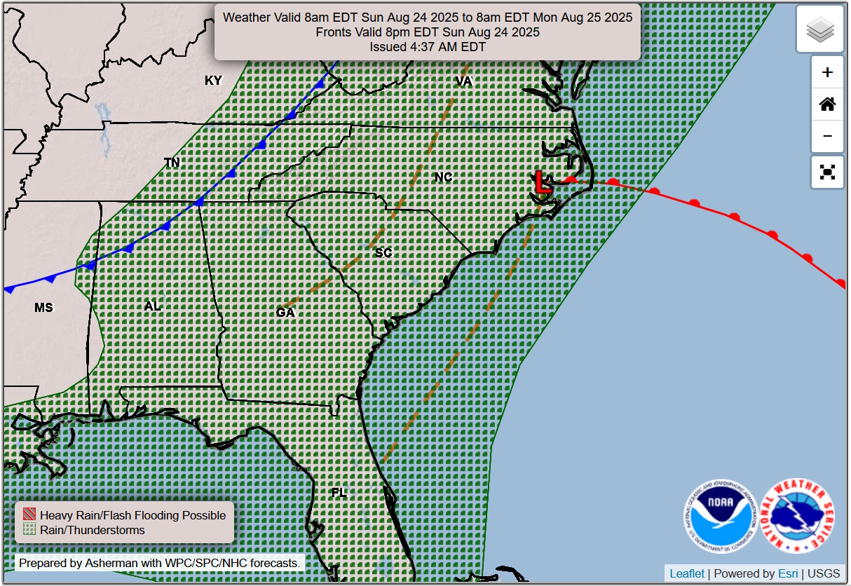
A pair of cold fronts — one strong cold front and a weaker one right on its heels — will whisk across the area Monday morning. This will (eventually) bring much cooler and drier conditions to Columbus County, which will last through the entirety of next week. Monday will start off with some clouds and then become mostly sunny… but I can’t rule out a rogue thunderstorm in the afternoon. Highs briefly jump to the upper 80s.
Cooler air starts to funnel in Monday night… and we’ll see temps in the mid 60s by time you get up for work and school on Tuesday morning. Much cooler temps with mostly sunny skies will dominate Tuesday through Friday with highs a degree or two either side of 80 (!!) and lows in the lower 60s….get out and enjoy it.
Tropics: Still watching two areas in the Atlantic. The first one will likely become a tropical depression or tropical storm by the time you read this article. Its course trajectory is nearly due-north and will have no impact on any land masses.
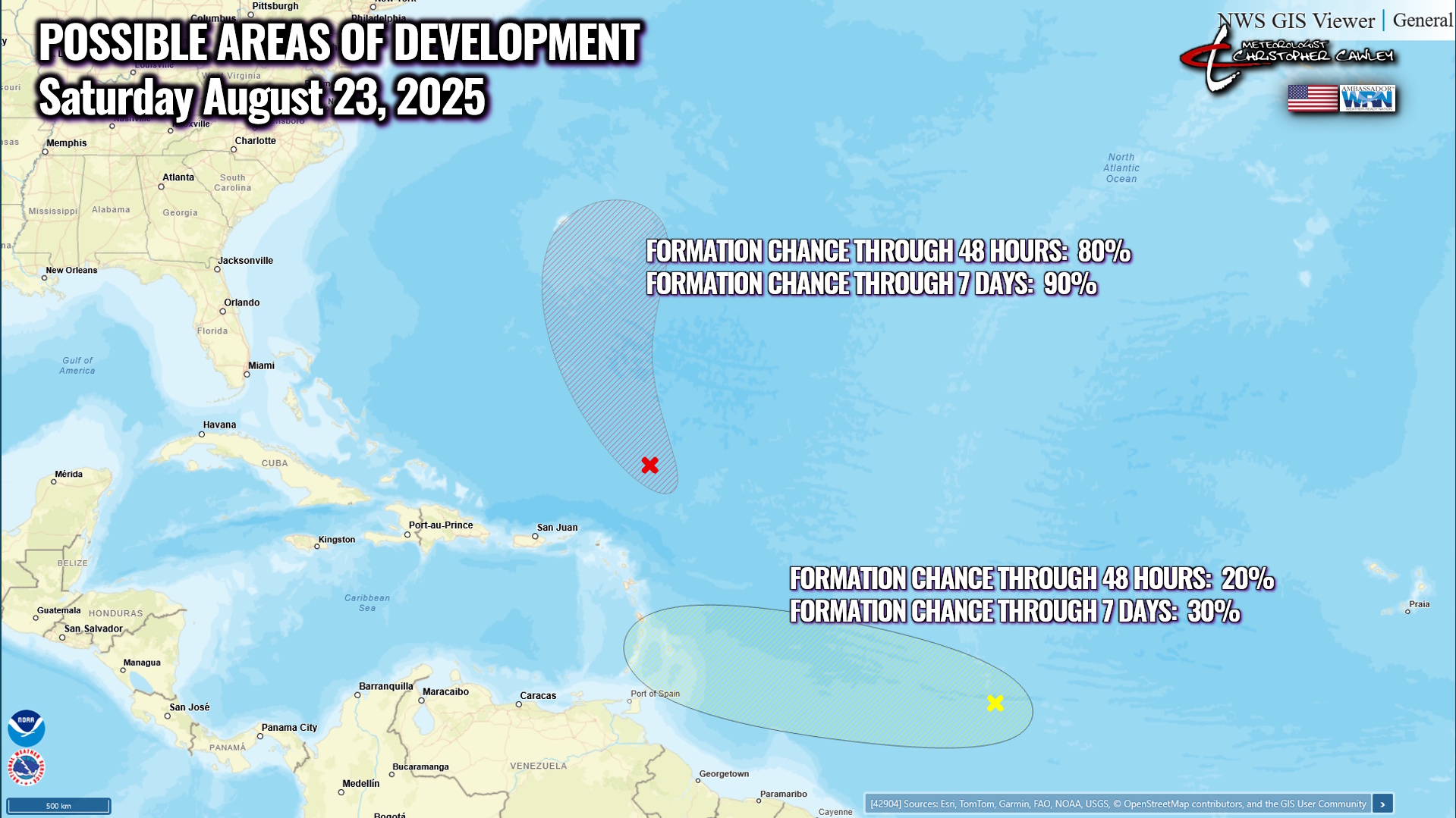
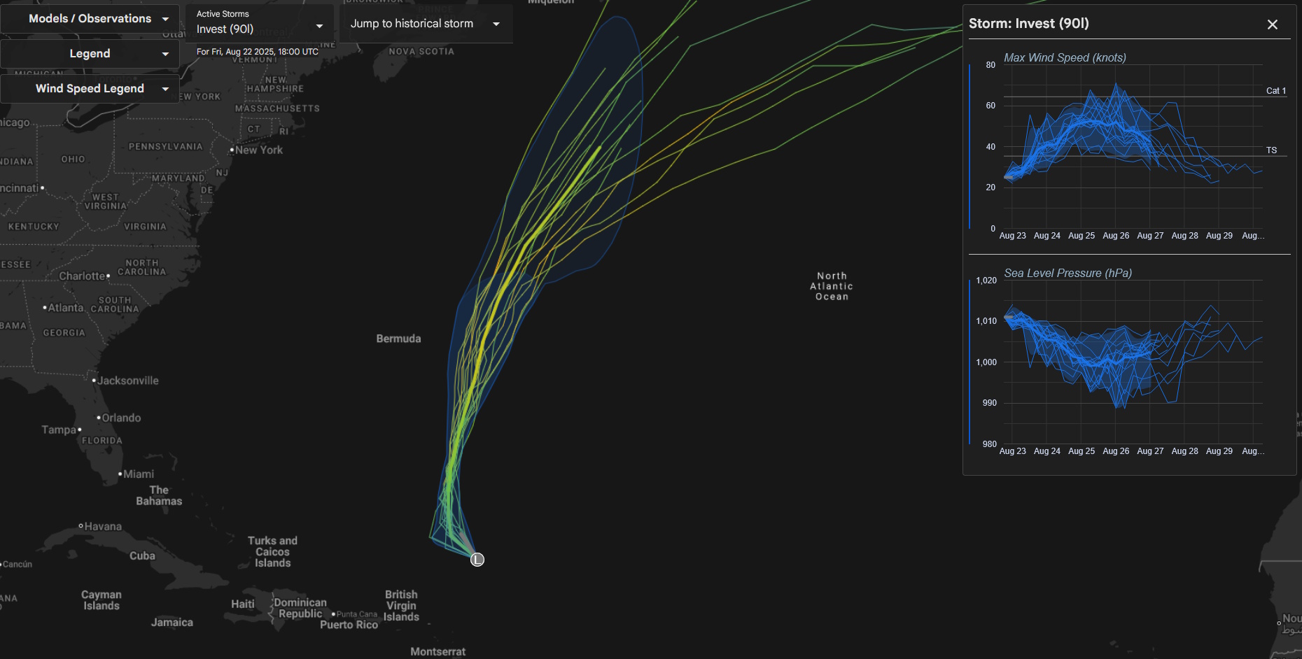
The second wave is fighting a losing battle with dry air and shear, and accordingly the National Hurricane Center has lowered its chances for development to 20%/30%. Should this hold together and continue to develop, a westerly course is likely… with models diverging on where it goes once it reaches the Leeward Islands. The system, like I said, is fighting a tough battle and it remains to be seen if it even comes together.
More tropical waves are set to come off the Africa coast, but as of right now, there are no tropical threats for the Carolinas within at least the next 2 weeks. We are now in the 2-month peak of tropical storm season (lasting through roughly October 20th). It’s important to stay up-to-date on the latest tropical weather, and the BEST place to look is the National Hurricane Center website.
Here is your Freedom Insurance Today-plus-Five Forecast:
–Meteorologist Christopher Cawley