CCN Weather Update for Monday August 25, 2025.
This weather update is sponsored by Freedom Insurance of Whiteville. No weather worries with Freedom Insurance. For home, car, boat, or whatever you need, Freedom can provide customized coverage to keep you and your family safe. Contact Freedom today at 910-640-2828!
Here’s today’s Bottom Line
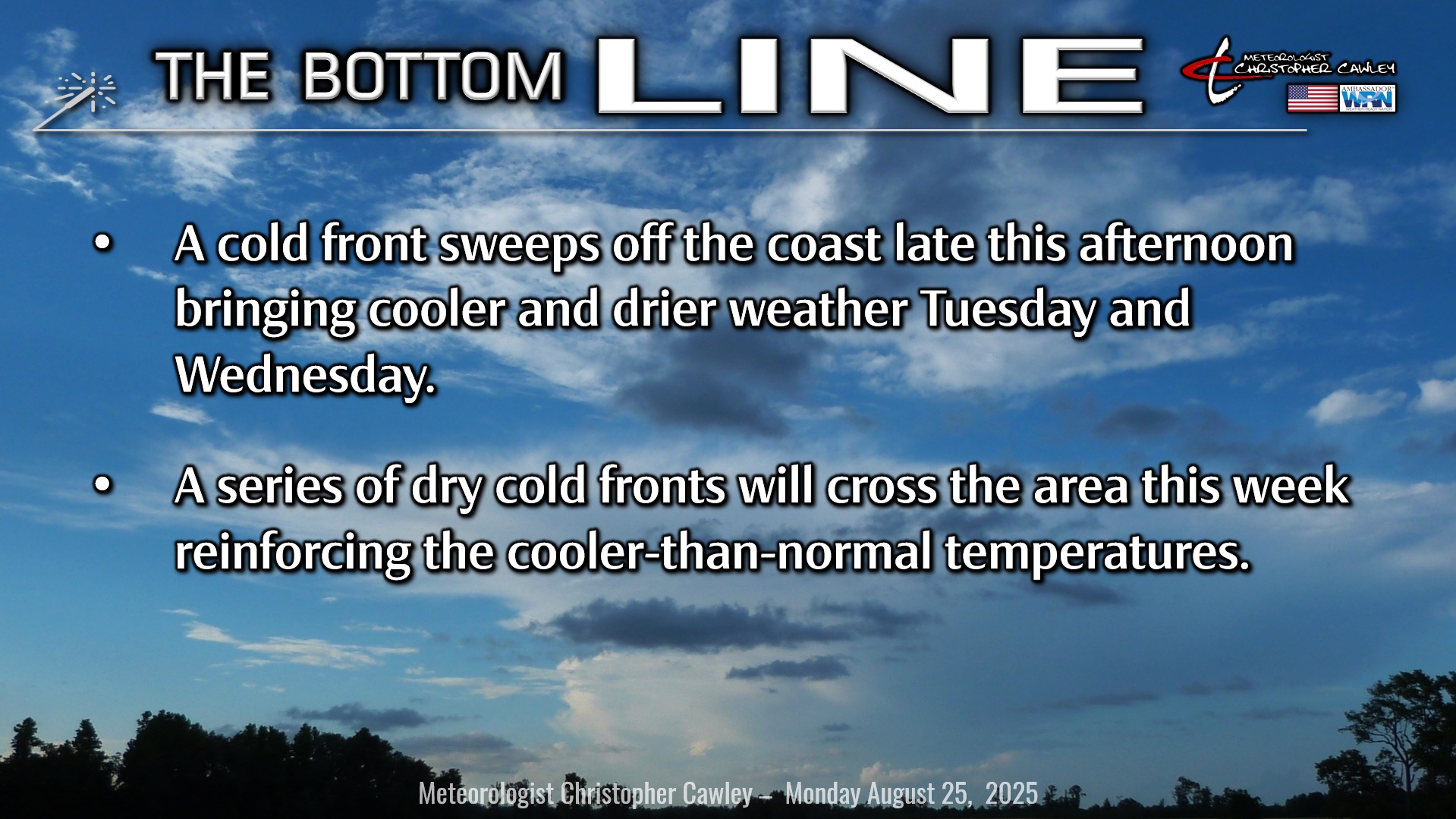
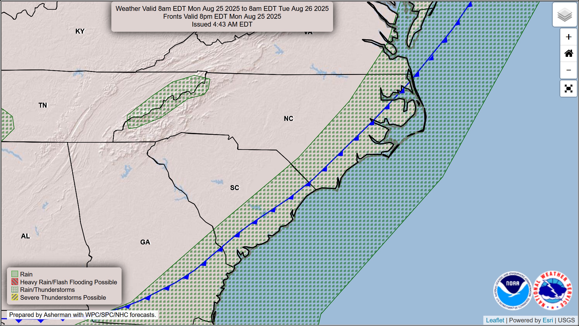
Today is going to be the final “hot” day we experience for at least a week. A pair of cold fronts will sweep across the region later this afternoon or early this evening. A few spotty showers or thunderstorms may develop in the southwest flow ahead of the fronts mainly this afternoon into early this evening.
Then the temperatures fall and rain chances become very low for the next 5-7 days.
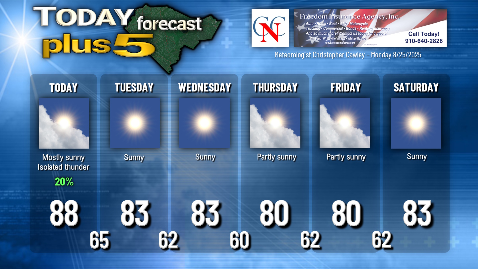
We’ll wake up tomorrow morning to temps in the mid 60s with clear skies. Expect lots of sunshine both Tuesday and Wednesday with low humidity and highs in the lower 80s… a good 5 degrees or so below seasonal normal values. Early morning lows will be around 60 into the lower 60s, but some outlying areas may dip into the upper 50s early Thursday morning.
Another cold front is expected to cross the area Thursday. This will bring some cloudiness to the area, and while some of the modeling paints a few green dots here and there, I’m going with a dry forecast as I think the dry air will win out. Temperatures around 80.
A third front sweeps across early Friday with similar conditions… some cloudiness… but what is called “silent POPs” in the business (rain chances so low it’s not worth putting in the graphics).
Dry weather looks to continue through the Labor Day weekend with temps running a good 5 degrees below normal both day and night.
As my meteorology mentor, Mr. Rich Lupia, used to say on his TV broadcasts, “get out and enjoy it.”
TROPICS: Tropical Storm Fernand will continue to lift north over the central Atlantic and will be no threat to any land locations.
A tropical wave near the Windward Islands does not yet have a “closed” low-level circulation. In other words, it’s not yet an actual depression. The system is producing lots of showers/storms and will impact the Leeward Islands today. The system has a rough road ahead if it wants to survive as conditions in the southern Caribbean aren’t exactly favorable for development. That being said, if it DOES develop, the majority of the plots take it into Central America.
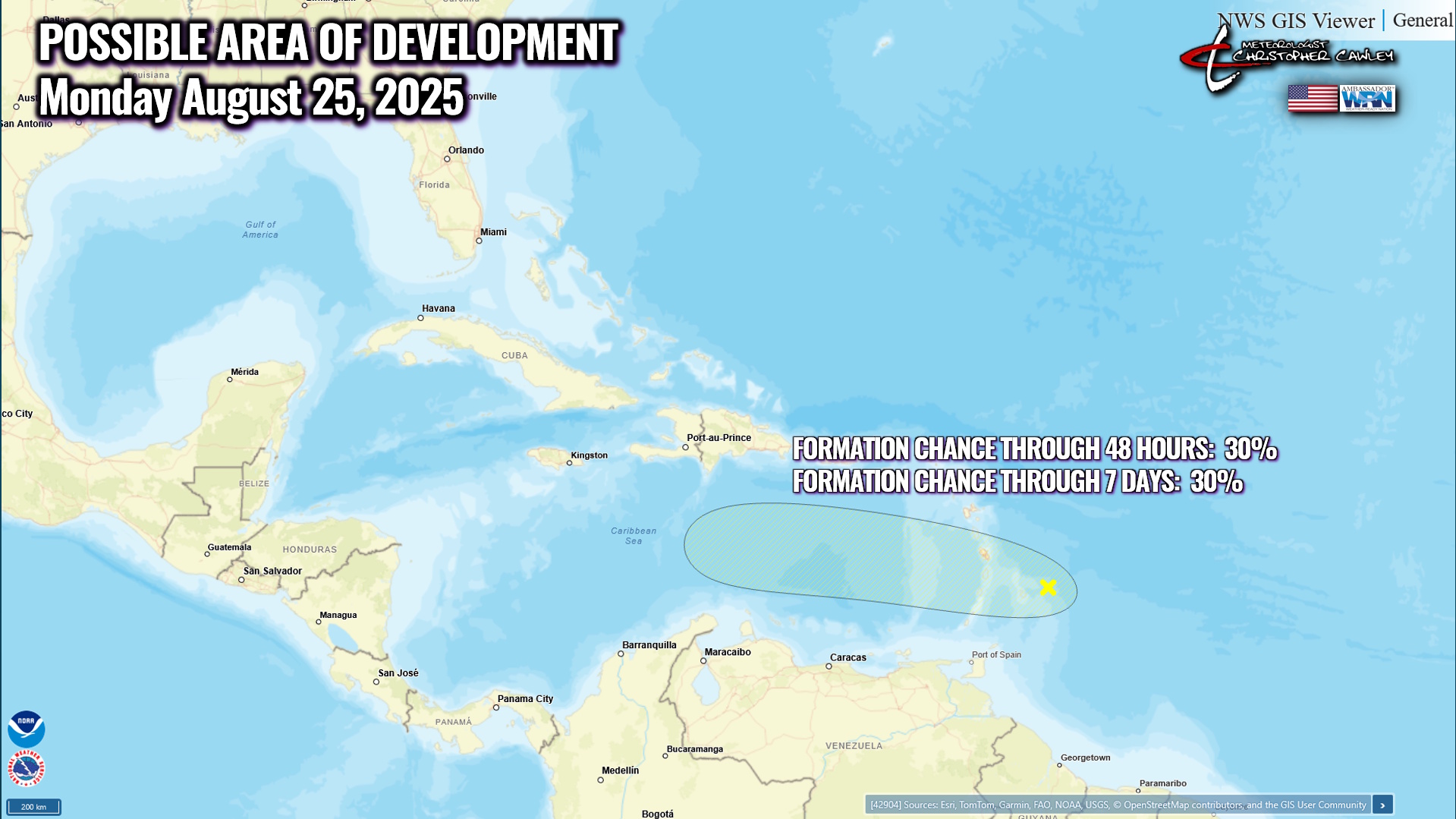
There are no threats to the Carolinas through the first full week of September.
Here is your Freedom Insurance Today-plus-Five Forecast:
–Meteorologist Christopher Cawley