CCN Weather Update for Wednesday September 24, 2025.
This weather update is sponsored by Freedom Insurance of Whiteville. No weather worries with Freedom Insurance. For home, car, boat, or whatever you need, Freedom can provide customized coverage to keep you and your family safe. Contact Freedom today at 910-640-2828!
Here’s today’s Bottom Line
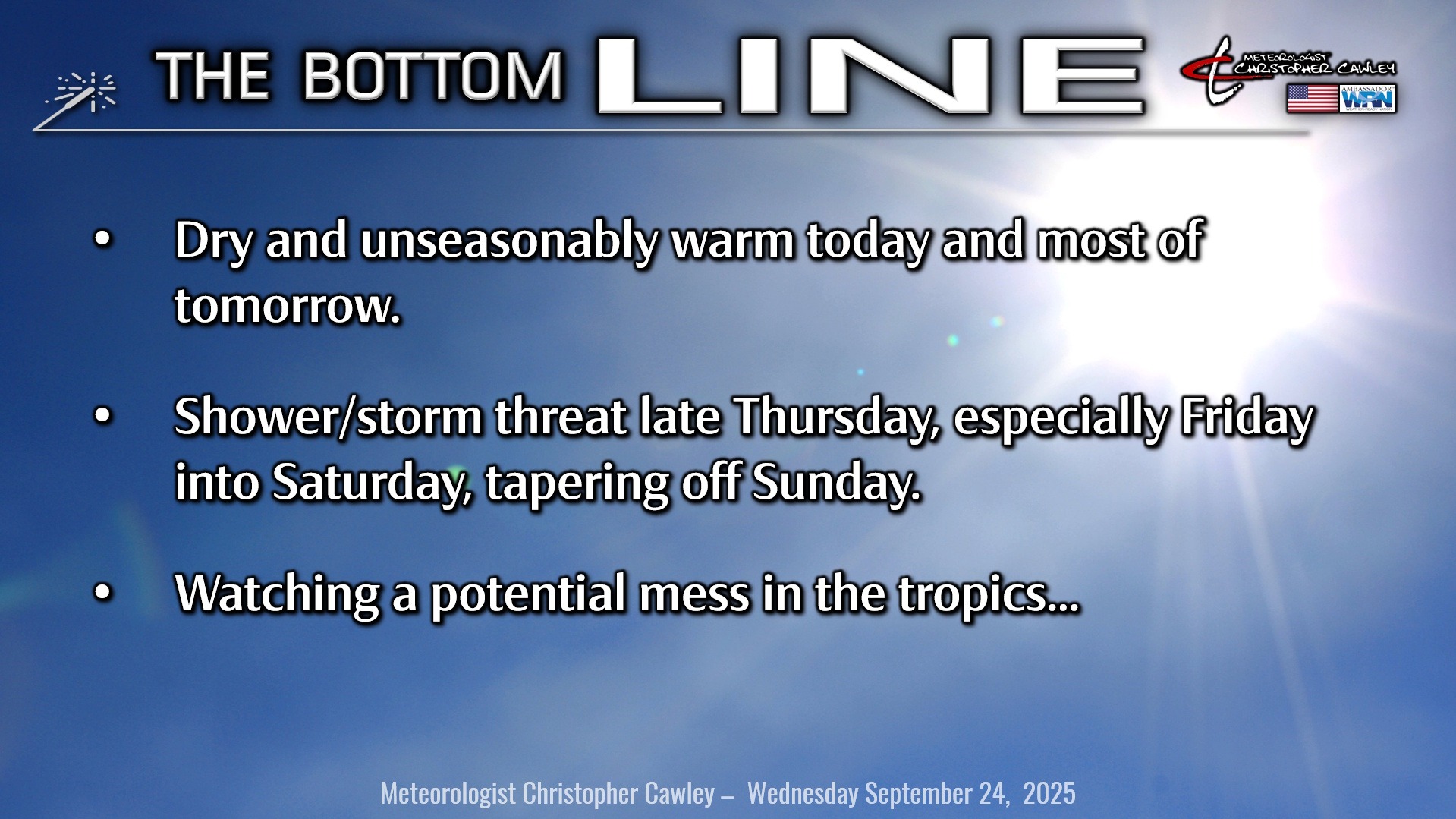
If you liked the weather yesterday, you’ll love today. And most of tomorrow, too. High pressure will finally relinquish control of our weather by Thursday afternoon, allowing a frontal system to approach the area.
First up to bat during the day Friday is a shortwave trough which will zip west to east, followed by the front itself by late Friday night. A little wave of low pressure is shown by modeling to spin up on the front as it approaches the beaches during the overnight hours or early Saturday morning.
Thursday should be mostly dry, but we’ll have a risk for late-afternoon thunderstorms in an unseasonably warm and moist southerly flow ahead of the advancing system. Temps ahead of any precipitation punch into the 90s on southerly winds.
The best chances for showers and possibly some strong thunderstorms will come Friday into Friday night. Some places could see a decent amount of rainfall depending on where the storms become established. The county is in a ‘D0’ drought status so this will be very beneficial rainfall.
Expect occasional showers to continue through Saturday as that secondary low spins up along the coast.
The frontal boundary then stalls along or just off the coast Sunday into Monday leaving at least scattered showers possible across the area. As the front starts to wash out along the coast our attention then turns to a situation evolving in the tropics……
TROPICS: Hurricane Gabrielle is currently located over the central Atlantic and will continue a rapid east-northeast course. Zero impacts to the Carolinas.
Next up we have… a mess, to be quite honest.
Let’s take a look at the modeling, first up the Euro, then the GFS.
The European is now tracking two storms early next week.
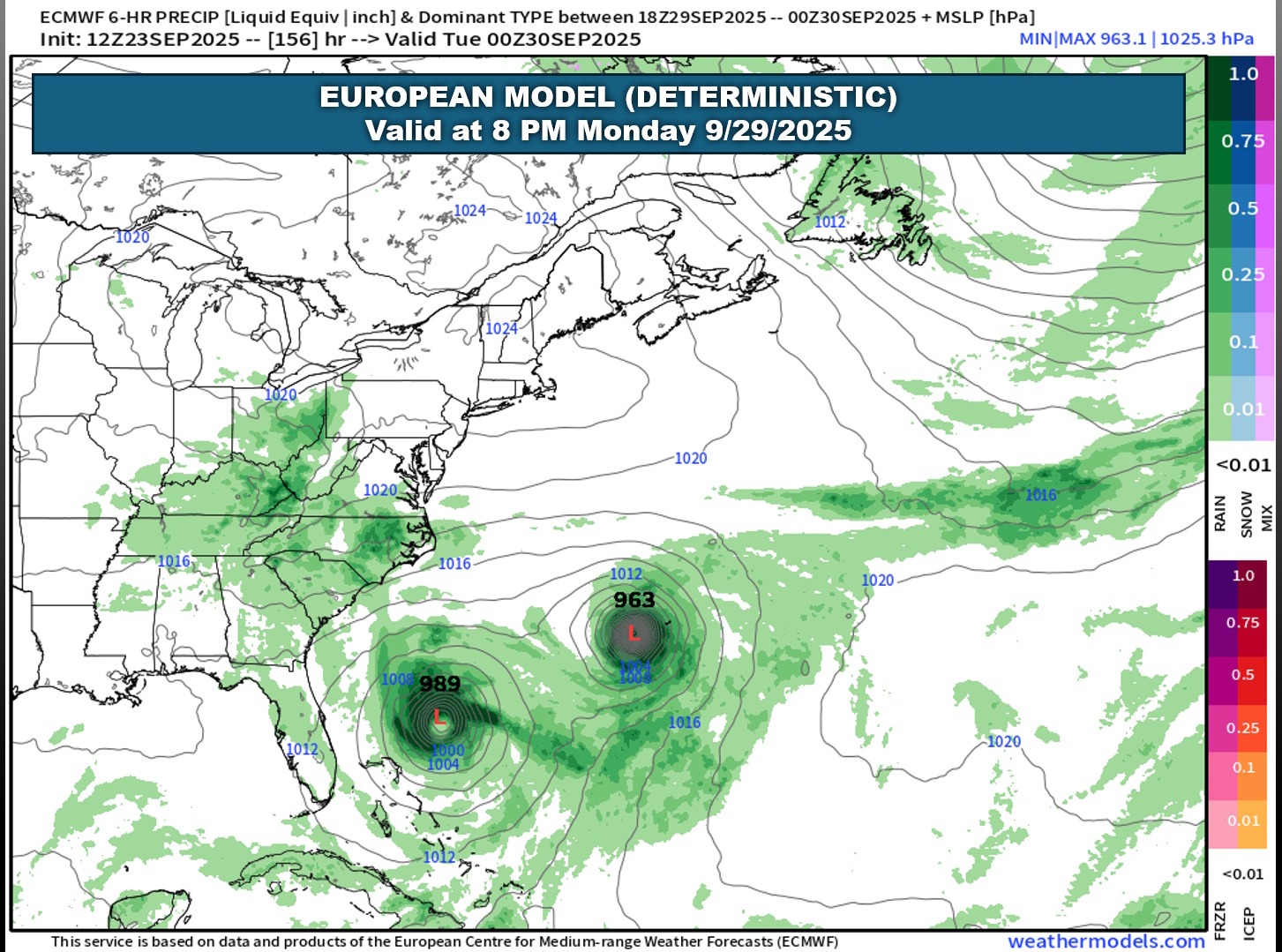
The model shows that both storms miss the coast but the one on the left cuts it kind of close to the Outer Banks. The frontal boundary is shown to become “washed out” prior to the storms arrival to this point (the map is valid for Monday evening).
A setup like this is not seen very often but can indeed happen. When two storms are in play close to one another they can influence each other’s path. This is something known as the Fujiwhara effect. Typically, one becomes stronger than the other and one falls apart… and this is shown quite clearly by the GFS.
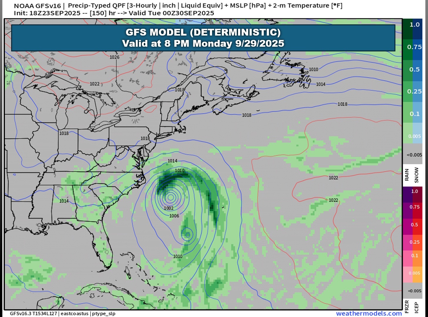
The GFS briefly shows two systems, but one falls apart while the other becomes the only system. While the model has it making a run at the coast, it misses the coast entirely.
So… what does that mean for our area? It’s too early to call, and any meteorologist of any value will tell you the same thing. We need to see how this system / these systems evolve. Among the unknowns is which storm will take over and be “dominant.”
Another unknown is whether or not the coastal front washes out. If the front stays intact, that pretty much guarantees a “miss” by any tropical system (tropical systems can’t cross a frontal boundary).
A third unknown is just how these storms, if they develop per the Euro model, interact with each other.
We simply need more time to watch how this comes together.
My honest “educated guess” is it’ll all be a miss here. I believe one storm will become the dominant and will bring some rough surf and rip currents, but I think that’ll be about it.
I don’t see any need to rush to the store for storm preparations. I don’t see any need for panic-shopping.
ANY impacts at all likely won’t be felt until late Monday through Tuesday, or Tuesday into Wednesday of next week. Definitely stay tuned, and if you want further updates beyond this report, please refer to official sources such as the NWS Wilmington and the National Hurricane Center. So-called “experts” roaming around social media are for entertainment purposes only. Stick with official sources.
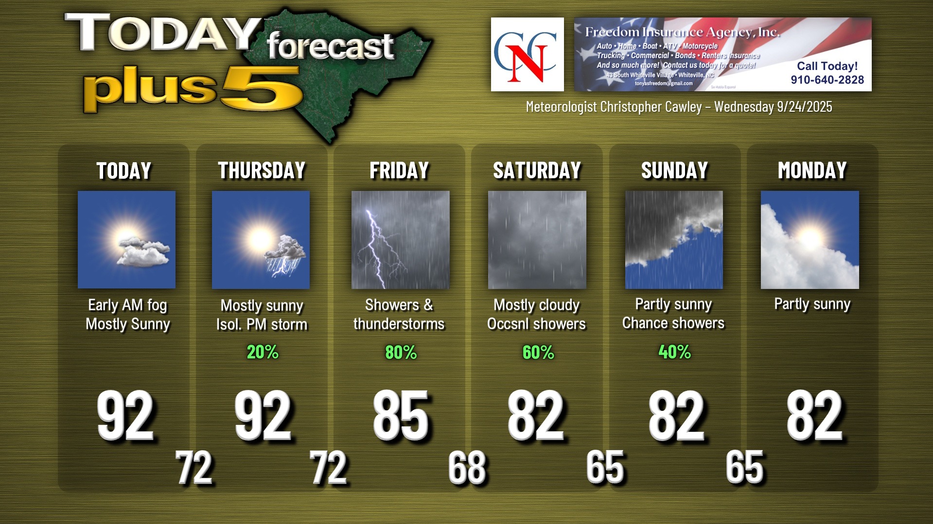
Here is your Freedom Insurance Today-plus-Five Forecast:
–Meteorologist Christopher Cawley