CCN Weather Update for Thursday September 25, 2025.
This is a long read today but I ask that you stick with it, as we combine the “regular” update and the tropics into one lengthy post.
This weather update is sponsored by Freedom Insurance of Whiteville. No weather worries with Freedom Insurance. For home, car, boat, or whatever you need, Freedom can provide customized coverage to keep you and your family safe. Contact Freedom today at 910-640-2828!
Here’s today’s Bottom Line
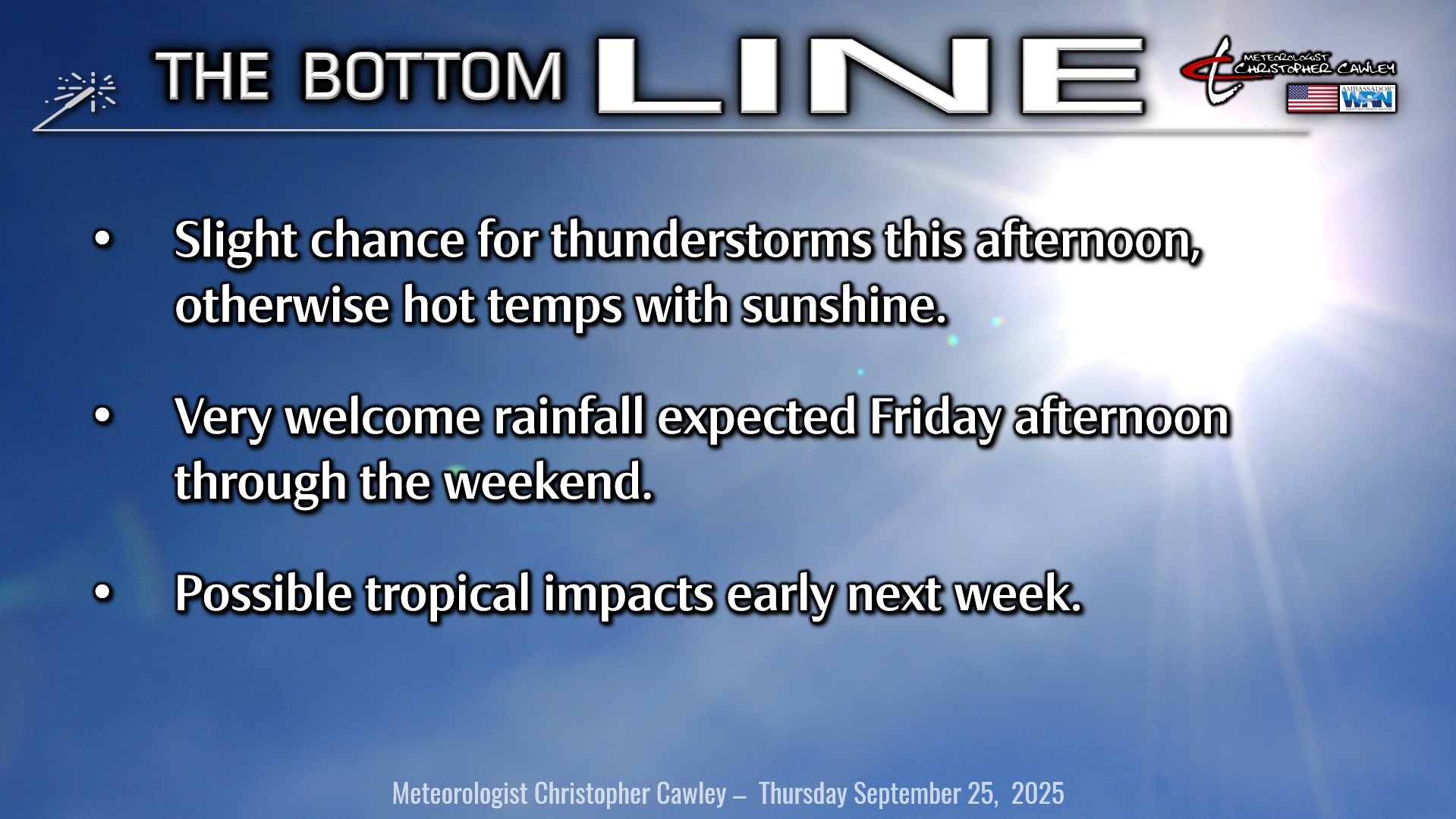
It’s going to remain unseasonably hot today with plenty of sunshine. This sunshine and heat will lead to lots of instability across the area this afternoon, and the threat for ISOLATED strong storms along the sea-breeze boundary. Thunderstorm activity farther inland (west of I-95) should shift northward toward east-central NC and away from our area… but a few stray storms could wander into our neck of the woods during the evening hours.
A couple of shortwave troughs move across the state Friday into Saturday, followed by a cold front. The more southern shortwave will be the primary impact on our weather here with shower and thunderstorm activity developing later Friday afternoon and really ramping up through Saturday. Rain chances continue Sunday into Monday as the front slowly pushes offshore.
SEVERE WEATHER POTENTIAL: Instability values will become elevated Friday afternoon and there is a low risk for isolated wet microbursts later Friday. There’ll be less surface-based instability on Saturday thanks to lots of clouds and showers.
The front finally clears the coast by Sunday, and then our focus turns to the longer term, especially Monday through Wednesday of next week… and an extremely low-confidence forecast.
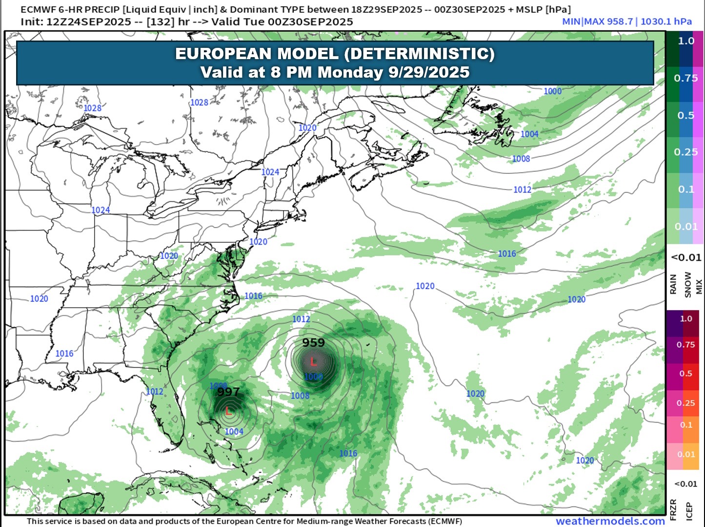
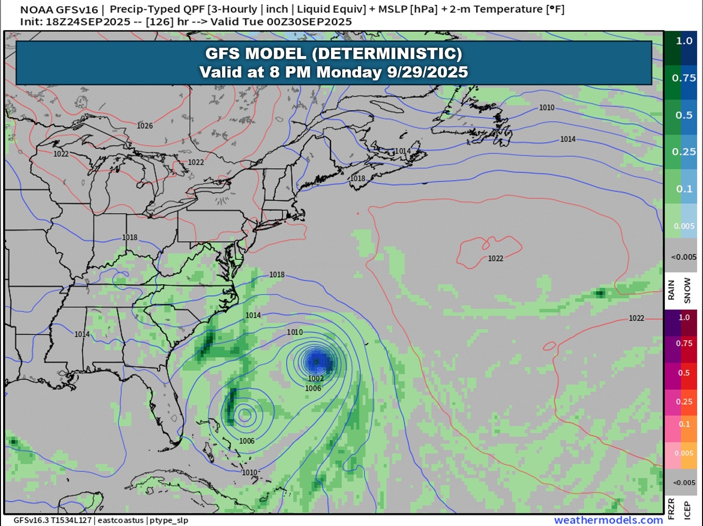
An upper-level low pressure center should be to our west by Saturday, and the global models show this lifting slowly northward over western SC and NC, and into western Virginia by Monday. The old frontal boundary lingers just offshore. The upper low and the front will act in a significant manner to steer tropical systems lurking offshore.
The majority of the ensemble models keep Humberto well offshore, curving safely to the north and probably hitting Bermuda. It’s the other system, known as “Invest 94” at the time of this writing, that will be the one to watch.
So here’s the situation. When you have two storms in close proximity, a phenomenon called the Fujiwhara effect can take place, where the storms tend to rotate around each other, with something of an “invisible center point” between the two. Usually, one storm becomes the dominant storm while the other one remains weaker, or becomes “absorbed” into the main storm.
The ensemble modeling is just all over the place with 94L. The majority keep this system steered off the coast… but there are a handful of plots that allow for more direct impacts.
The images below are the European deterministic and GFS deterministic charts valid for 8 PM Monday. This represents just one snapshot.
I’m not going to attach the ensemble model plots (the “spaghetti plots”) because they will change (possibly significantly) depending on when you read this, and since this blog is only updated once a day, I don’t want to have “stale” forecast information. I will update my Facebook page after work this afternoon with the latest information. I’m certain that the hype train folks, “authority” and “expert” posters on social media will be all over this. Ugh.
The bottom line: Humberto should stay comfortably out to sea, but there’s some question on how he interacts with the developing I94L (which could become Imelda). I94L will likely be steered by the remnant frontal boundary along the coast, the upper low over the mid-Atlantic, and Humberto. Where that system goes is unknown at this time. We’re just going to have to wait to see how this evolves.
I do not believe we have any need for panic. Even a direct impact by the I94L would result in, at worst, rainy and breezy conditions early next week… but nothing that will be particularly newsworthy. While it will be entertaining to watch (especially on social media with the hype train), my gut instinct is that both systems stay offshore. But definitely stay tuned!
Official links–
National Hurricane Center
NWS Wilmington
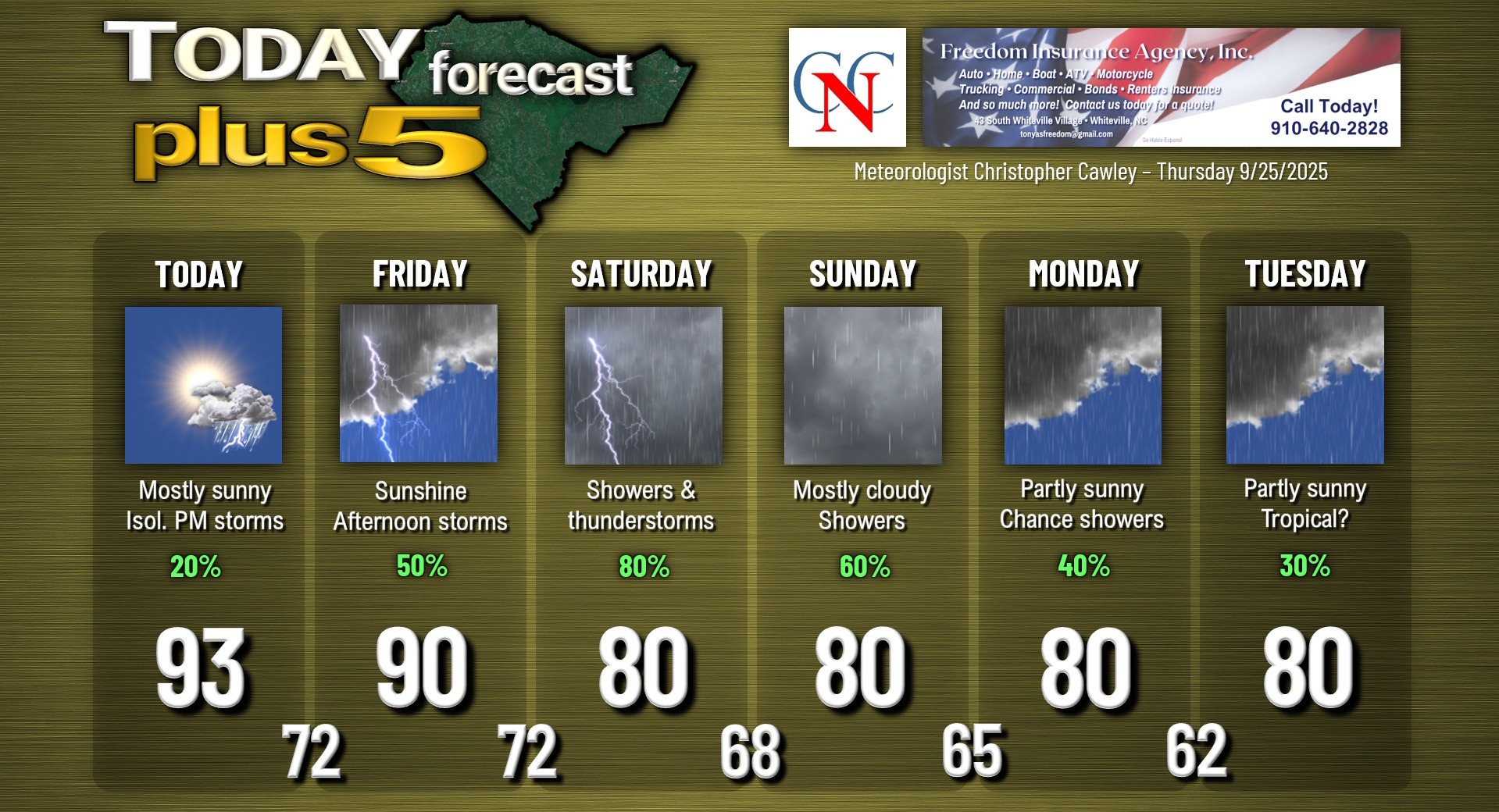
Here is your Freedom Insurance Today-plus-Five Forecast:
–Meteorologist Christopher Cawley