CCN Weather Update for Friday September 26, 2025.
Like yesterday, this is a long read… but I ask you stick through it.
This weather update is sponsored by Freedom Insurance of Whiteville. No weather worries with Freedom Insurance. For home, car, boat, or whatever you need, Freedom can provide customized coverage to keep you and your family safe. Contact Freedom today at 910-640-2828!
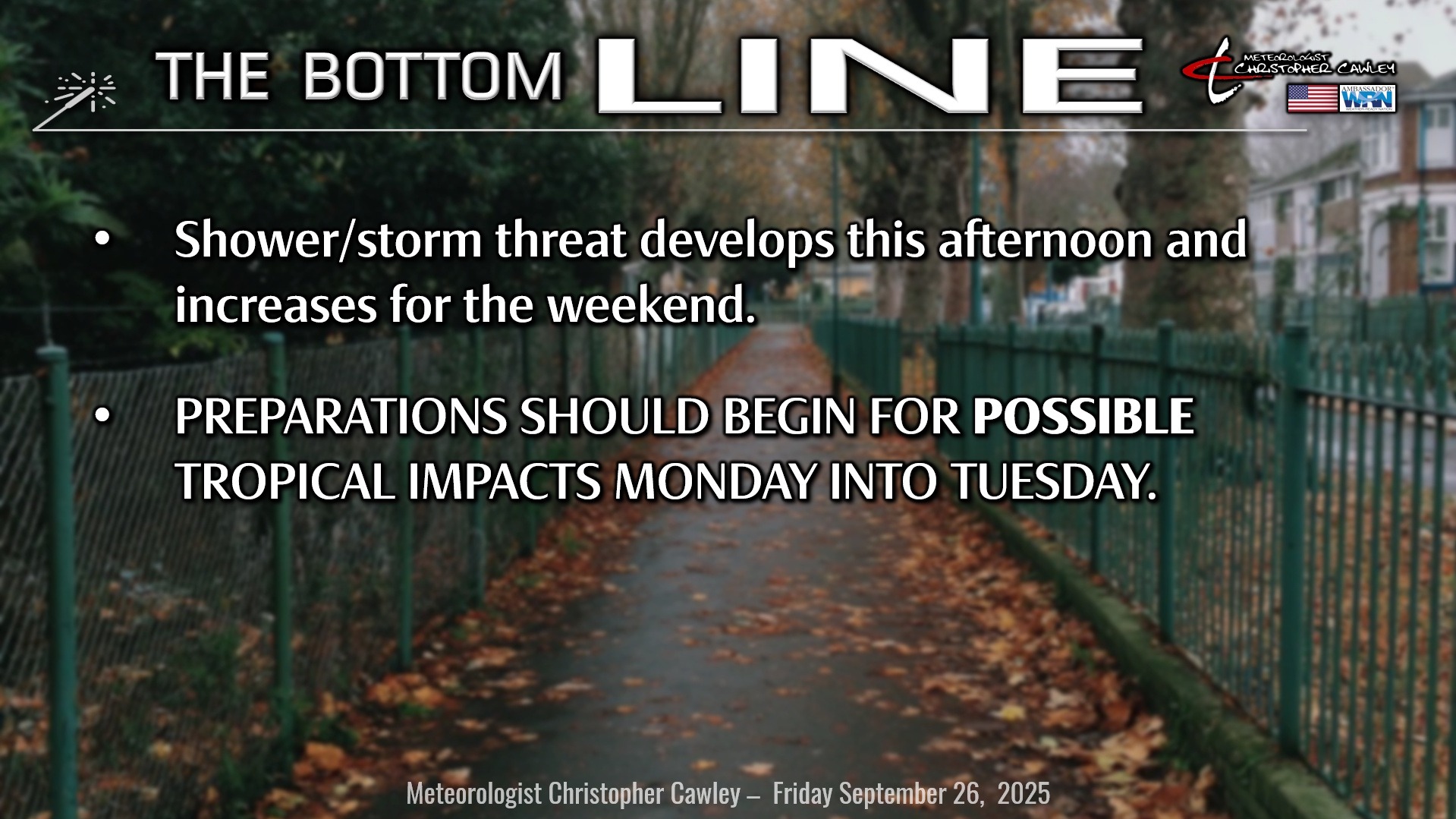
BEGIN PREPARATIONS NOW FOR *POTENTIAL* IMPACTS FROM A TROPICAL SYSTEM ON MONDAY INTO TUESDAY.
Here’s today’s Bottom Line
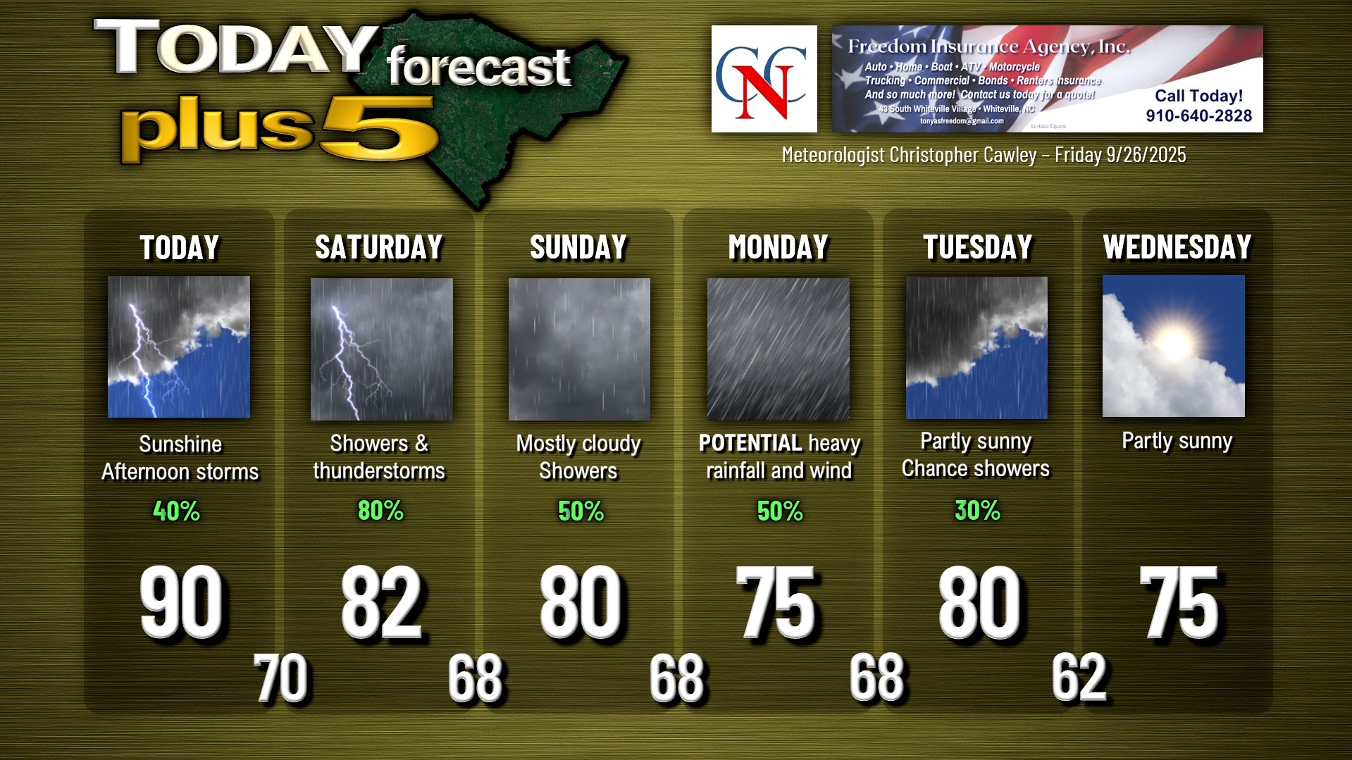
Several shortwave troughs and finally a frontal system will cross the area today through early Sunday. Showers and thunderstorms should start to develop this afternoon, picking up in coverage tonight, through Saturday, and into Sunday before the front finally pushes offshore and washes out. Rainfall over the area of 1-2 inches is possible, and some spots may pick up more.
Normally I’d spend more time with analysis on this system, but the tropics is the big story, so here goes.
We have what remains a very low-confidence forecast. Invest 94L, still near the Dominican Republic at the time of this writing, will likely develop into “Imelda” near the Bahamas some time today, maybe even by the time you read this article. Definitely by tonight into Saturday.
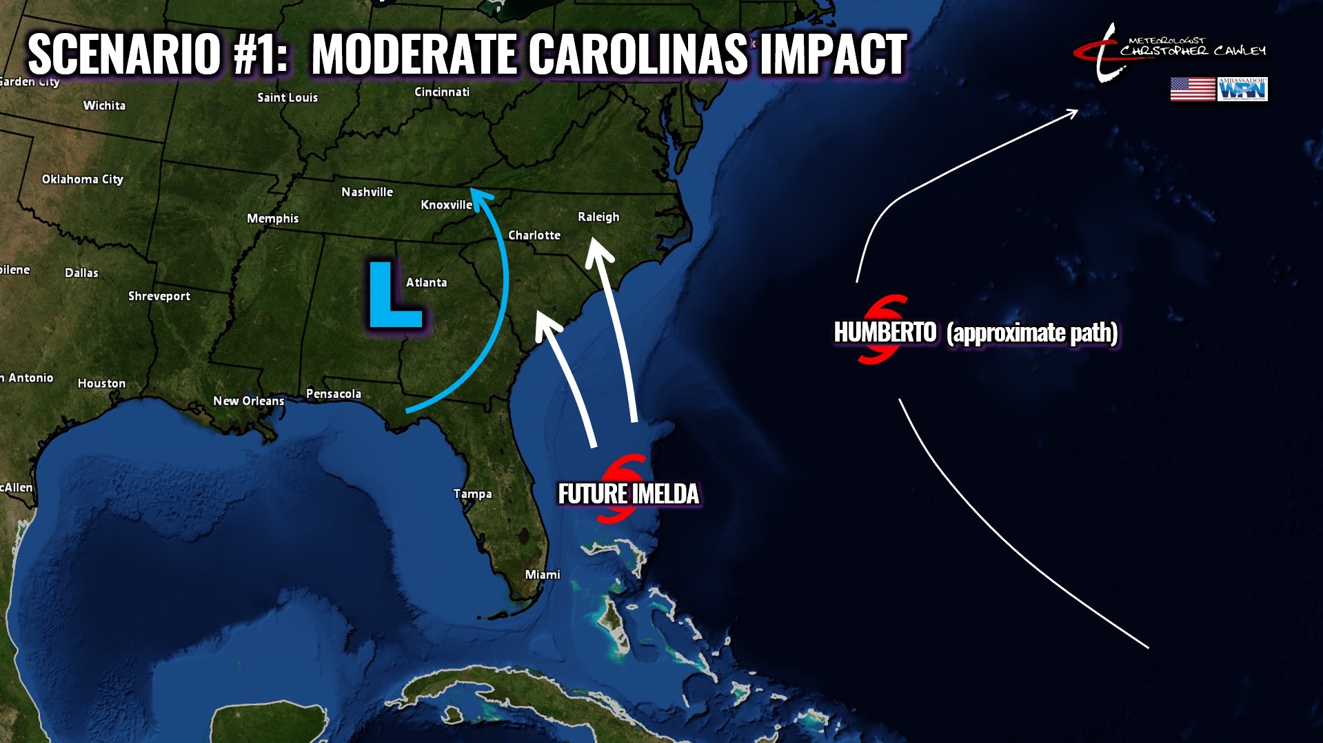
Where it goes from there will be driven in large part by the position of an upper-level low across the southern Appalachians and by what will be Hurricane Humberto.
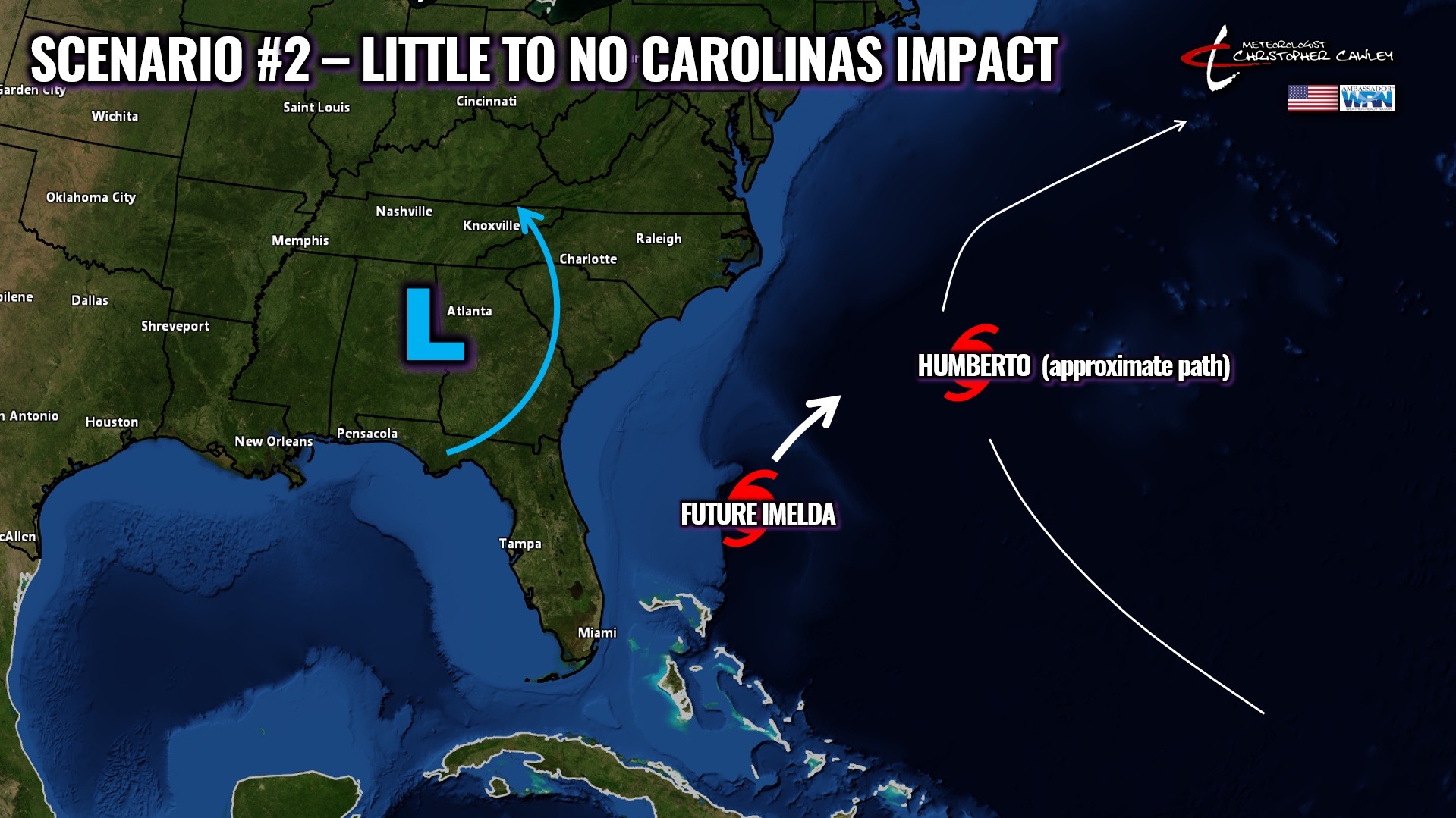
Speaking of Humberto… he will have zero impact on the Carolinas. None. Nada.
Yesterday I mentioned that an upper-level low was expected to lift northward into western Virginia. Well that no longer appears to be the case, and all available modeling pushes the low farther southwestward (over Georgia) by early next week. This opens a “road” that would be traveled by Imelda toward the Carolina coast.
There are two main scenarios at play here.
SCENARIO #1: I94L develops and stays west (closer to the coast), and is captured by the upper low with a Carolinas landfall. Given a certain level of shear that will likely exist along the coast, the storm would be a high-end tropical storm or low-end cat-1 hurricane at landfall (instead of something stronger). This would result in moderate to possibly significant Carolina impacts including flooding rainfall and winds, as well as a tornado threat as Columbus County would end up in the right-front-quadrant.
SCENARIO #2: I94L stays weak (stays as a tropical depression or low-end tropical storm), or moves slower and stays farther to the east (away from the shore). Interaction with Humberto near Bermuda would pull I94L/Imelda farther eastward and well off the southeast coast, resulting in zero impacts to the Carolinas, other than dangerous rip currents at the beaches.
Which scenario is most likely? Either one. None is favored over the other. Confidence is really low… REALLY low.
Because of that, I think it would be prudent at this time to begin reviewing hurricane action plans for you and your family.
You can bet I’ll be watching each model run. Like yesterday, I’m not going to post spaghetti plots, because they’ll already be “outdated” depending on when you read this article.
FLOODING RAINFALL THREAT: I say this part not to frighten people, but to emphasize the need for preparedness: Should scenario #1 end up being the winner, FLOODING RAINFALL WILL BE A THREAT TO THE AREA. The latest NWS model blend, for what it’s worth at this early juncture, paints generally 4-8 inches of rain across much of the Carolinas… but this includes the rainfall that we’ll pick up Friday PM through Sunday, in addition to whatever comes Monday/Tuesday. If the center of the storm lifts into the Carolinas, it’s not unrealistic to imagine upping those numbers by 5-10+ inches.
And now the near-impossibility: STOP BELIEVING THE HYPE NONSENSE ON SOCIAL MEDIA. It’s off the charts with all of these so-called “authorities” and “experts” coming out of the woodwork… getting hundreds of shares. Stop.

Trust OFFICIAL sources such as local degreed meteorologists, local media outlets, the National Weather Service, and the National Hurricane Center.
Here is your Freedom Insurance Today-plus-Five Forecast:
–-Meteorologist Christopher Cawley