

CCN Weather Update for Sunday October 26, 2025.
This weather update is sponsored by Freedom Insurance of Whiteville. No weather worries with Freedom Insurance. For home, car, boat, or whatever you need, Freedom can provide customized coverage to keep you and your family safe. Contact Freedom today at 910-640-2828!
Here’s today’s Bottom Line
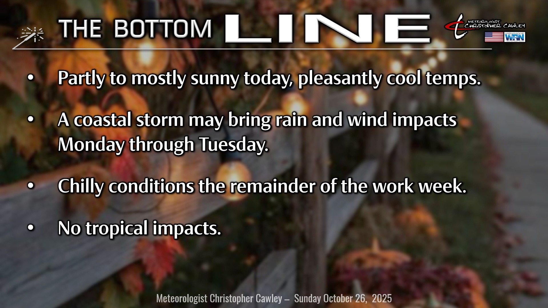
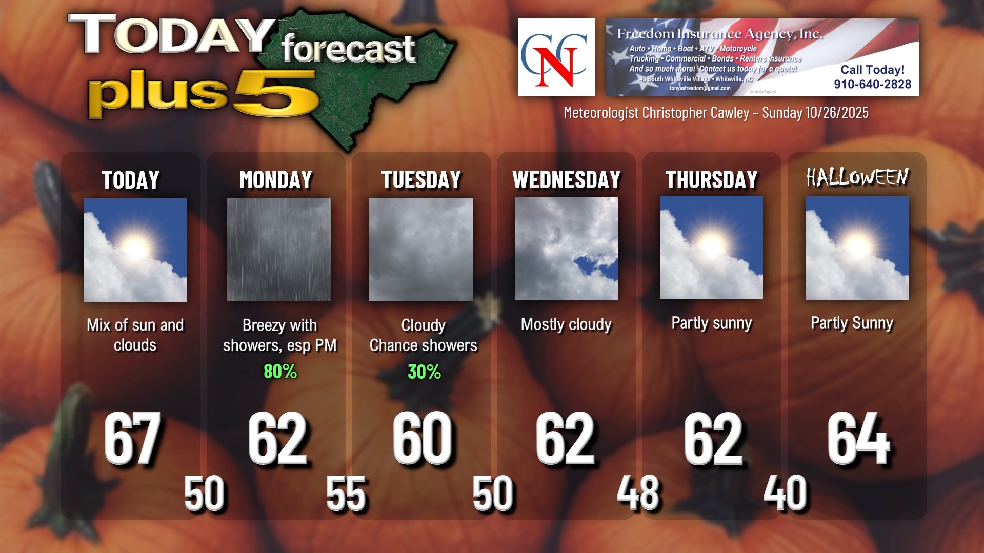
One final nice day across the area before CHANGE takes place. Expect a mix of sunshine and clouds for today with temps in the mid to upper 60s.
High pressure will ridge southward from southern Pennsylvania late tonight, while a coastal frontal boundary becomes established. Low pressure will spin up along this coastal front… but the question-marks remain as to precisely WHERE the storm comes together, and how strong the storm will be.
I should note – this is a non-tropical low.
Expect showery conditions on Monday, especially in the afternoon, through Monday night into Tuesday, with chilly temps… significantly below seasonal normal values.
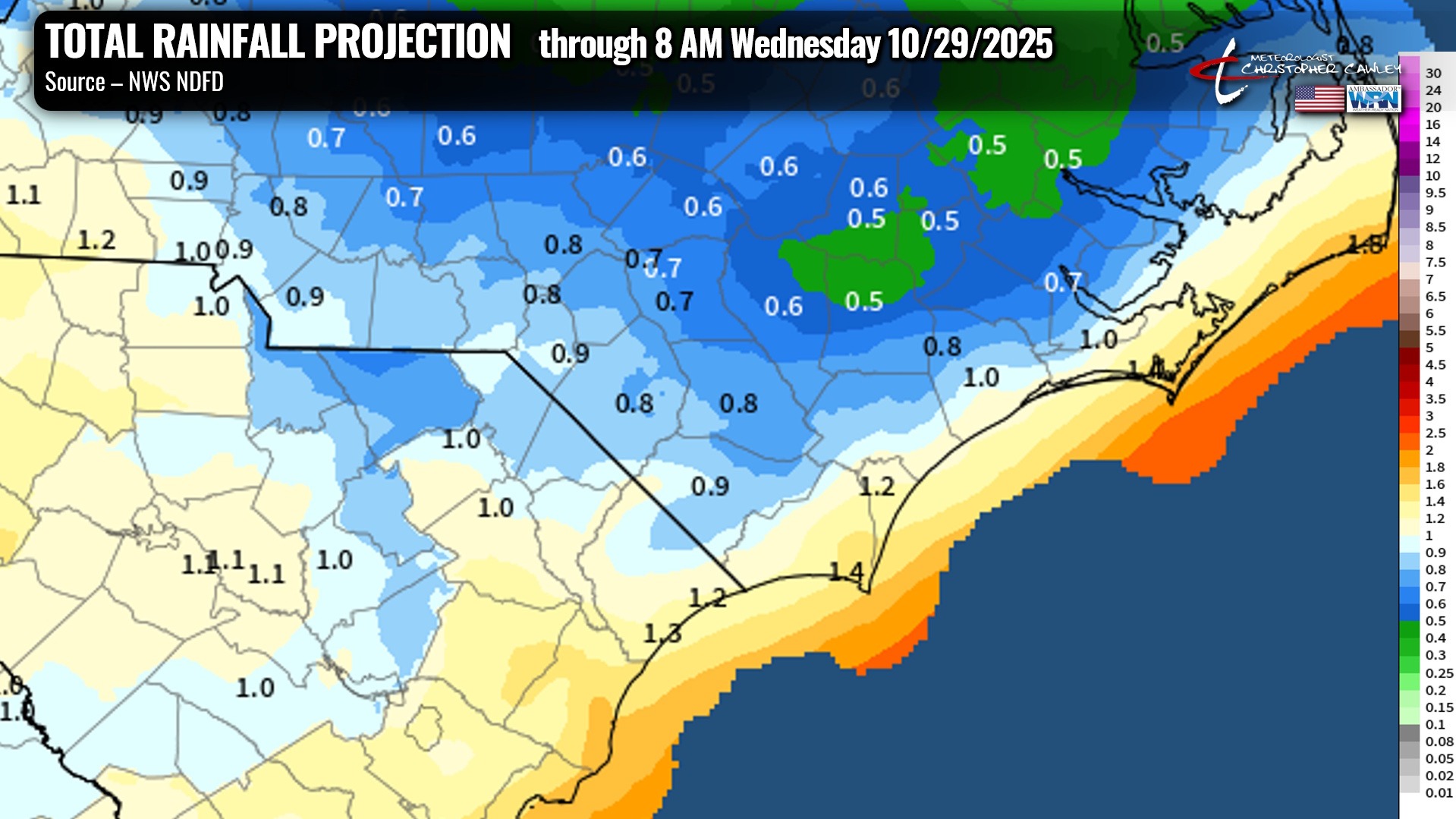
As of this writing, the rainfall amounts should be between 0.5 and 1.0 inch across the area. This will be HIGHLY DEPENDENT on the eventual storm track. A storm track closer to the coast will mean significantly more rainfall across the area, while a storm track farther offshore (as advertised by the GFS) means much lower total rainfall.
The storm will be slow to pull away, and a second area of low pressure may spin up right behind it… I’m not sold on that yet. Thus, I’m going with mostly cloudy skies Wednesday and Thursday with temps continuing to run below normal.
TROPICS: Our poor friends in Jamaica… some of the higher terrain will experience absolutely staggering rainfall amounts, mudslides, etc., BEFORE being slammed directly by a potentially category-5 Melissa.
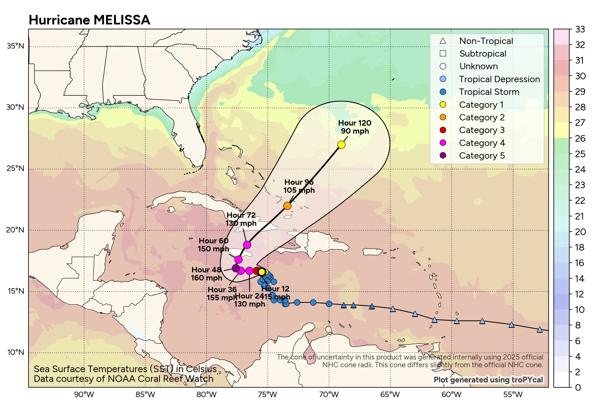
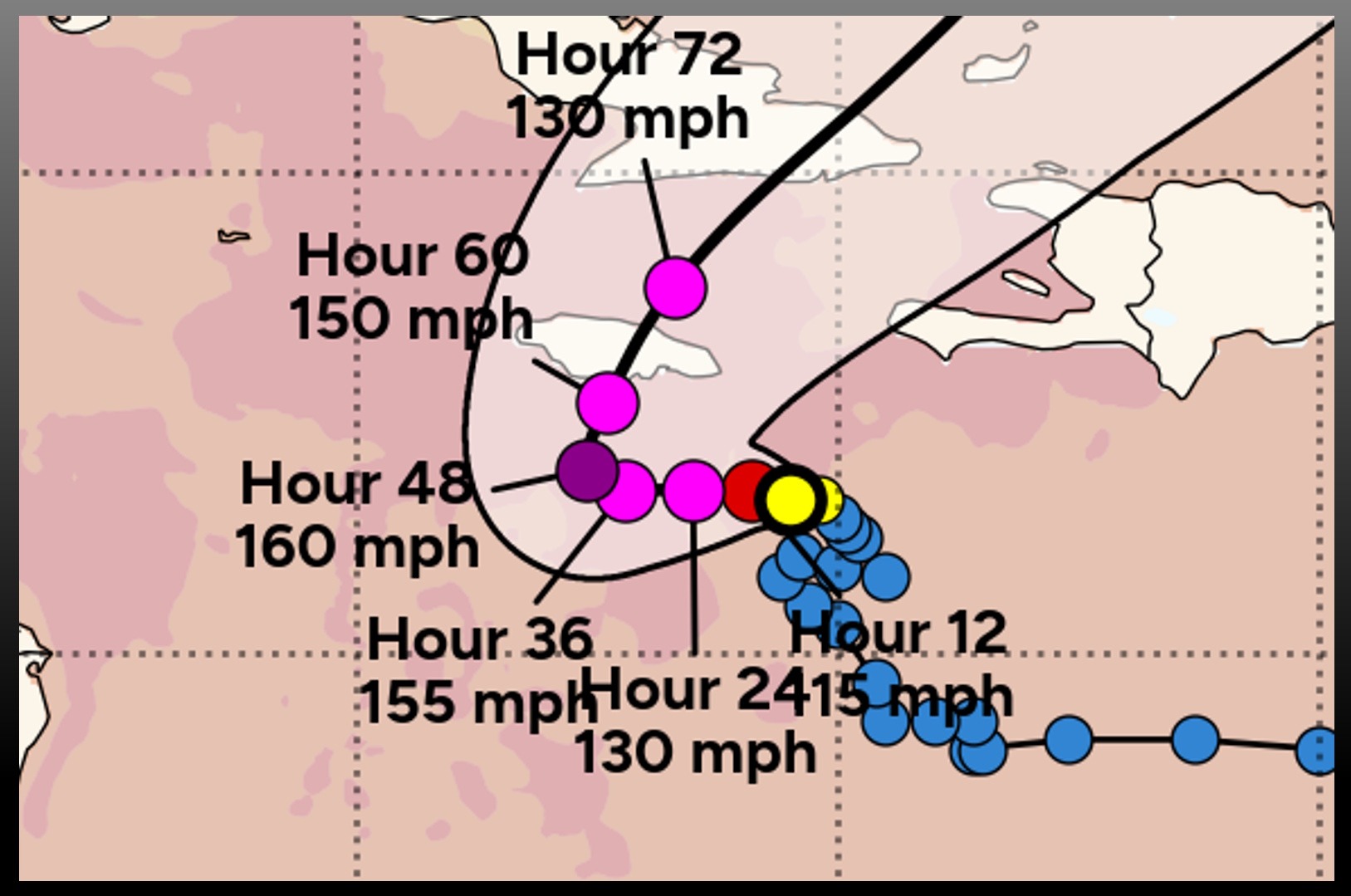
She will pose no threat to the mainland US.
Here is your Freedom Insurance Today-plus-Five Forecast:
–Meteorologist Christopher Cawley