CCN Weather Update for Thursday December 4, 2025.
This weather update is sponsored by Freedom Insurance of Whiteville. You can trust Freedom Insurance to give you clear blue skies when it comes to home, car, boat, or whatever insurance you need. Let Freedom provide customized coverage to keep you and your family safe. Contact Freedom today at 910-640-2828!
Here’s today’s Bottom Line
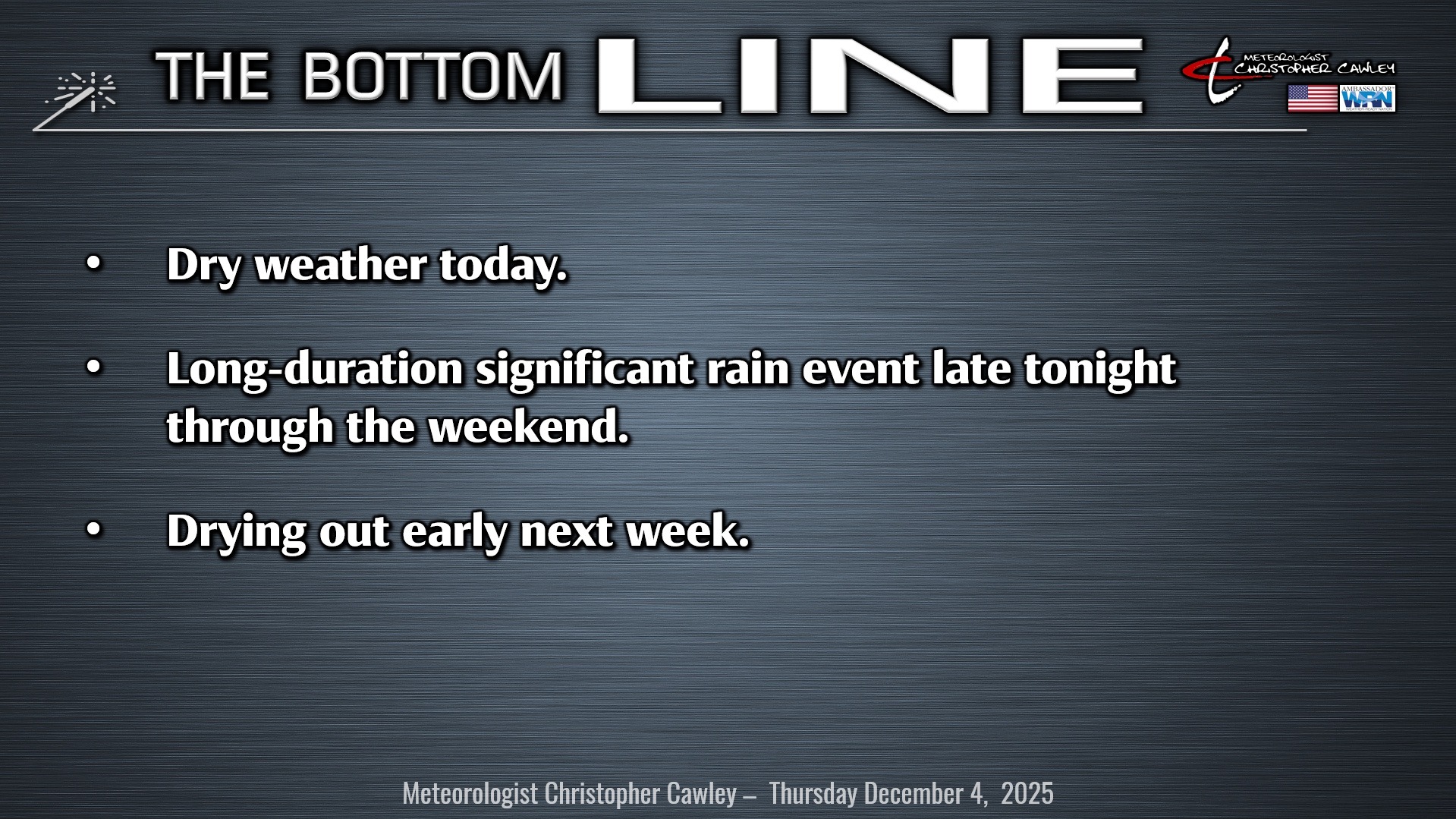
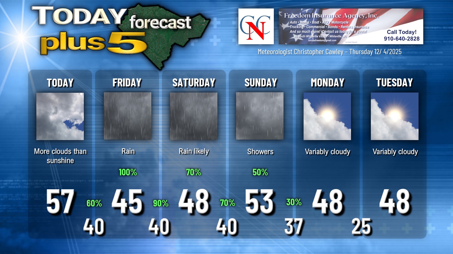
Weak high pressure will keep us dry today, but there’ll be lots of clouds increasing through the afternoon hours. We won’t see the sunshine again until Monday.
A frontal boundary will drop south across the area late this evening or during the overnight and then stall along the coast.
WEEKEND WASHOUT
Several waves of low pressure will then lift north/east along the front, along the coast, beginning on Friday and lasting through Sunday. This will bring significant rainfall to the county during the period.
The first wave lifts up the coast on Friday. Rain should develop before daybreak Friday, and then persist through the day and evening. Rain is likely to be heavy at times, and at least minor flooding of low-lying and poor-drainage areas is a concern.
There have been some mentions on social media about a frozen precip potential. While that is true farther north and west, that won’t be the case here. It will be a cold rain with temperatures essentially steady in the 40s through the whole event.
Friday is just going to be a cold, rainy day. Period.
A second wave of low pressure lifts along the frontal boundary for late Friday night through Saturday. The location of the low and front remains of question at this time… there’s the chance that most of the rain for Saturday could be pinned to northeast South Carolina and along the immediate Cape Fear coast. I’m going to stick with my gut though, and consistency, and keep rainy conditions in our forecast for Saturday. I may revise that for Friday morning’s report.
As far as the Whiteville Christmas parade goes, yeah it’s going to be a dicey forecast. Modeling suggests that whatever rain we get on Saturday *should* come to an end for the evening hours. If things sag farther to the south and east, then there’s an even better chance we’ll get the festivities in without a hitch.
The final low spins along the front later Saturday night into Sunday. The same uncertainty exists… that being how far south/east the low will run. I’m going to put “showers” in my forecast for Sunday, but I’m going with a 50% chance to cover the considerable uncertainty.
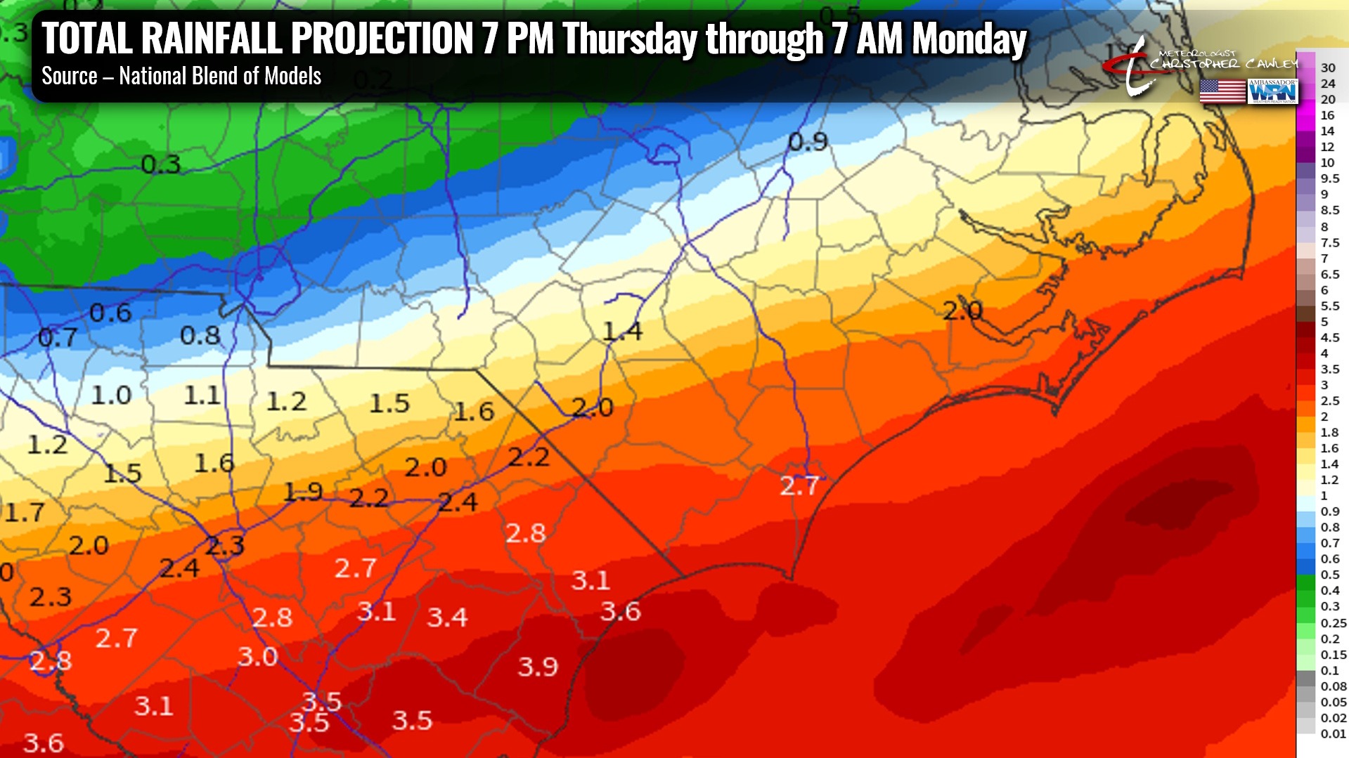
Model blends suggest a total of 2 to 3 inches of rain for the county from late this evening through early Monday morning.
A drying trend finally looks to take place early next week. With the front still lingering to our south, this will allow cold temperatures to persist through at least Tuesday, if not even longer.
Here is your Freedom Insurance Today-plus-Five Forecast:
–Meteorologist Christopher Cawley