CCN Weather Update for Saturday January 17, 2026.
This weather update is sponsored by Freedom Insurance of Whiteville. You can trust Freedom Insurance to give you clear blue skies when it comes to home, car, boat, or whatever insurance you need. Let Freedom provide customized coverage to keep you and your family safe. Contact Freedom today at 910-640-2828!
Here’s today’s Bottom Line:
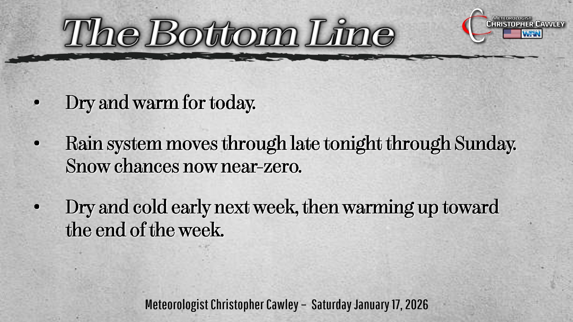
Well, friends, if you’re hoping for snow tomorrow, I have some unfortunate news to pass along.
In a classic example of how things can change… and a reason why we shouldn’t be clicking on the “static” seen on social media… a decent rain event will take place from late tonight lasting through about suppertime on Sunday.
All rain.
Cold rain.
An Arctic front will move across the area late tonight. Expect light rain to break out from southwest to northeast after midnight. A wave of low pressure will form along the front, and the shield of rain becomes widespread by time you head off to church on Sunday morning. Rain… of moderate intensity at times… will continue through the afternoon before tapering off from southwest to northeast around suppertime.
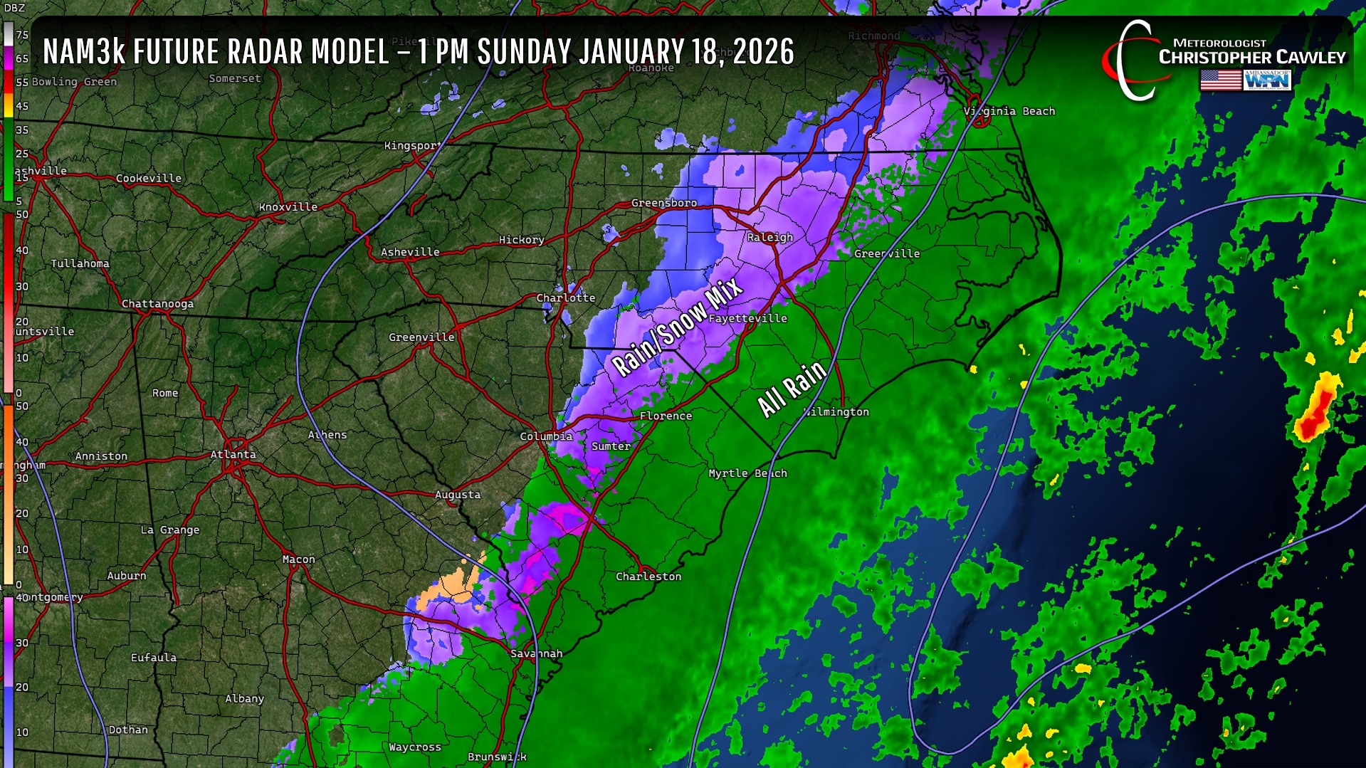
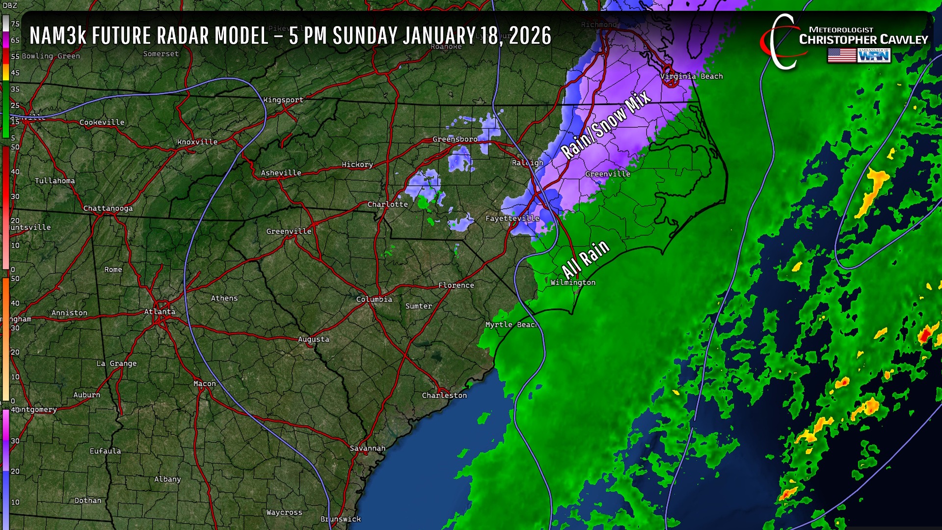
Any frozen precip stays well to the west and the north. Colder air — that is, air cold enough to support snow — won’t move into our region until after the precip has ended.
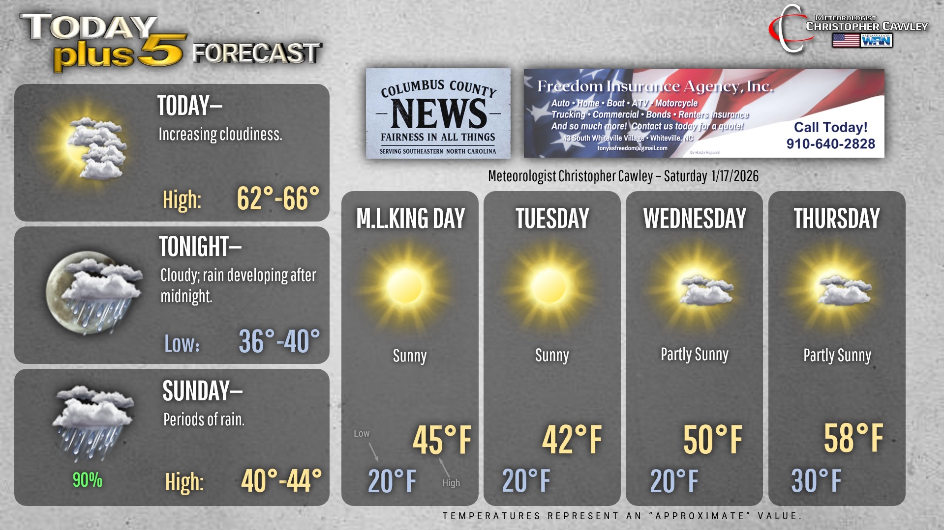
BLACK ICE will become a concern after sunset on Sunday, lasting into early Monday. You will need to use extreme caution if you have any Sunday evening/Monday morning travel plans.
Model blends show rain totals between a quarter and half an inch across the area, and that seems reasonable given the available moisture.
As mentioned, skies clear out Sunday night and it gets quite cold once again, with lows early Monday morning around 20 degrees. Despite full sunshine on Monday, highs only reach the lower and middle 40s.
A reinforcing shot of colder air arrives on Tuesday, and some of the modeling suggests we don’t even reach the 40-degree mark. I went on the warmer end of guidance, though, with a high in the lower 40s.
Then a warmup begins by midweek. After another cold night Tuesday night, highs rebound on Wednesday to around 50… and then into the upper 50s (possibly around 60) on Thursday.
After the system this weekend, we’ll be completely dry through the coming work week.
Here’s your Freedom Insurance Today-plus-Five Forecast!
–Meteorologist Christopher Cawley