CCN Weather Update for Sunday January 11, 2026.
This weather update is sponsored by Freedom Insurance of Whiteville. You can trust Freedom Insurance to give you clear blue skies when it comes to home, car, boat, or whatever insurance you need. Let Freedom provide customized coverage to keep you and your family safe. Contact Freedom today at 910-640-2828!
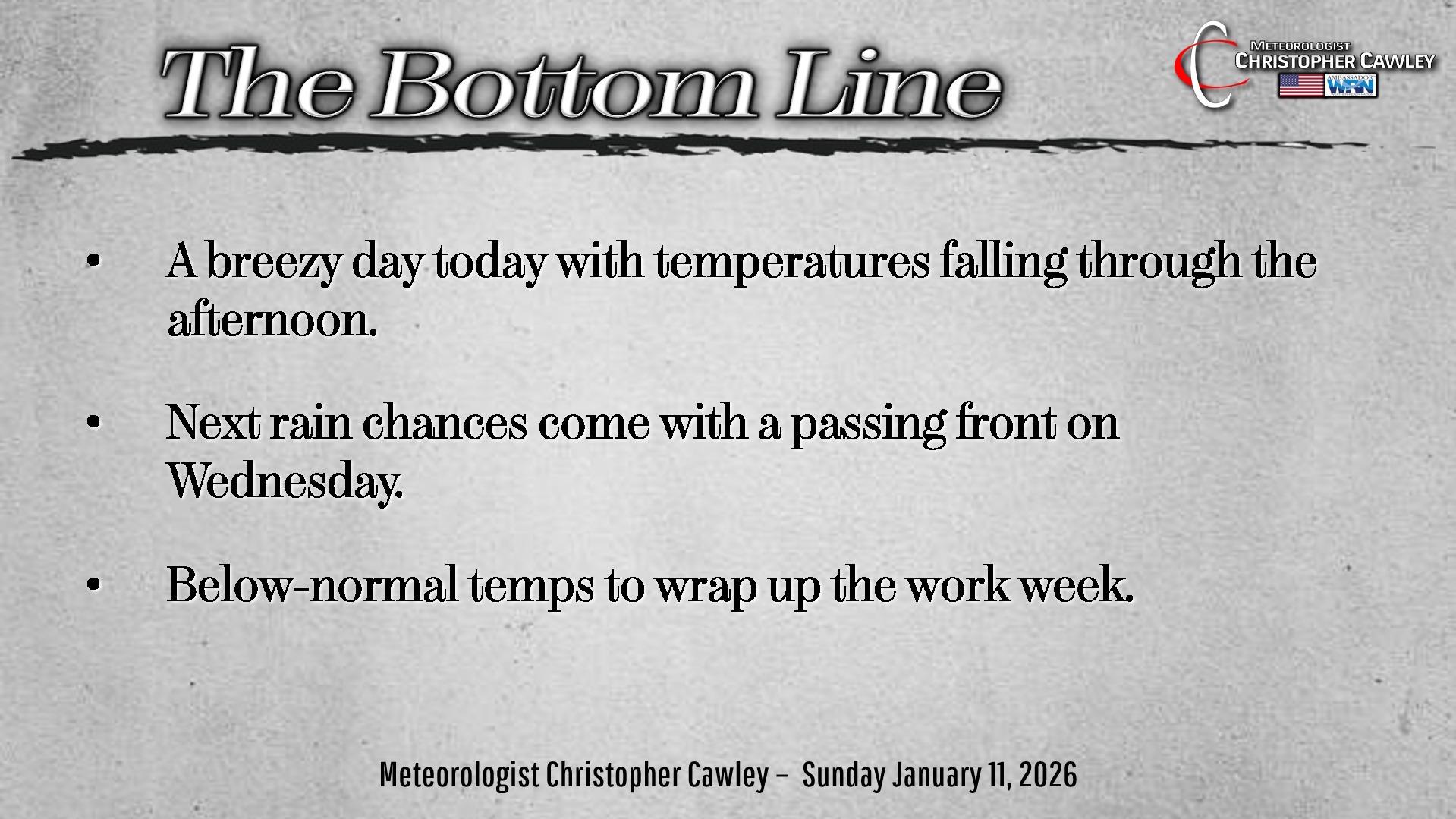
Here’s today’s Bottom Line:
Greetings and happy Sunday!
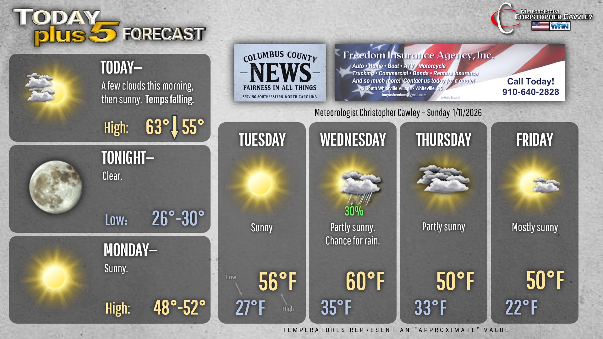
Strong cold front has moved through the area and we’ll be left with breezy conditions, increasing sunshine, and falling temperatures for today. A few isolated rain showers are possible first thing this morning, but whatever we get won’t amount to much.
There will be an elevated fire danger today given tumbling humidity values, the dry ground, and breezy conditions. Please use extreme caution if you have any burning plans.
Benign conditions will be the rule through early Wednesday. It’s going to get cold tonight/Monday morning, and again Monday night/Tuesday morning, but afternoon highs on Tuesday will be right at seasonal normal values.
For today, we’re in the 60s first thing this morning, but by time you sit down to supper, it’ll be around 50 and on the way down.
Temps solidly in the 20s at the bus stop Monday. Despite full sunshine on Monday, highs will struggle to the 50-degree mark. We’ll fall back into the 20s for early Tuesday with milder temps, like I said, for Tuesday afternoon.
The next weather system arrives by Wednesday. Medium range model ENSEMBLES show deep troughing and perhaps a “cut off low” developing in the lower Appalachians by Thursday. (A cut off low is one that is, well, “cut off” from the typical progressive weather pattern.)
Unfortunately, any significant moisture will be displaced offshore. Some showers are possible with a frontal passage on Wednesday, but that’s about it.
Now, I’m VERY AWARE that many people are seeing folks on social media talking about snow later in the week. Again, I look at model ensembles to get a better idea of the “big picture,” and, well, it ain’t looking too good if you’re rooting for snow. Not this week anyway.
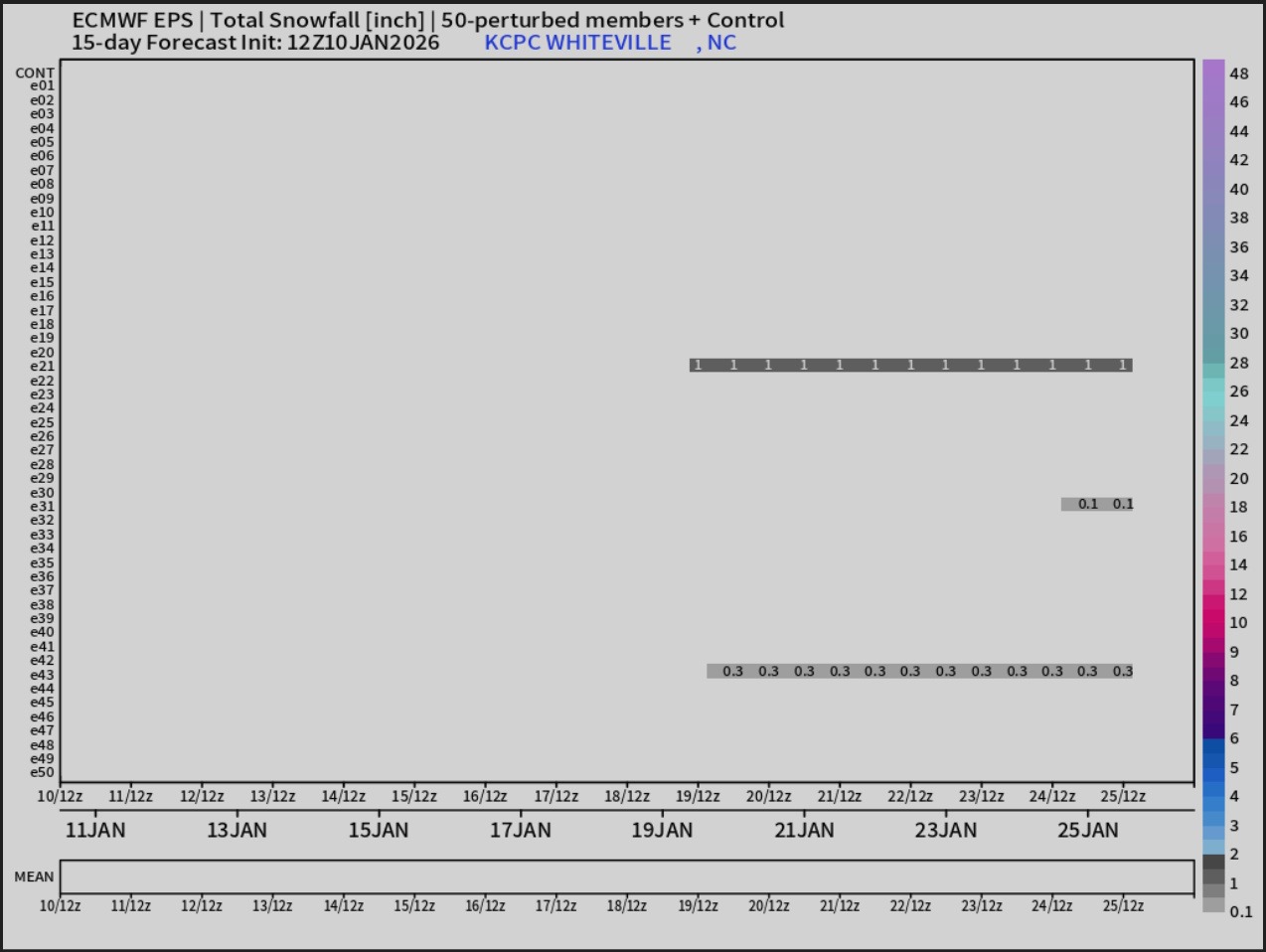
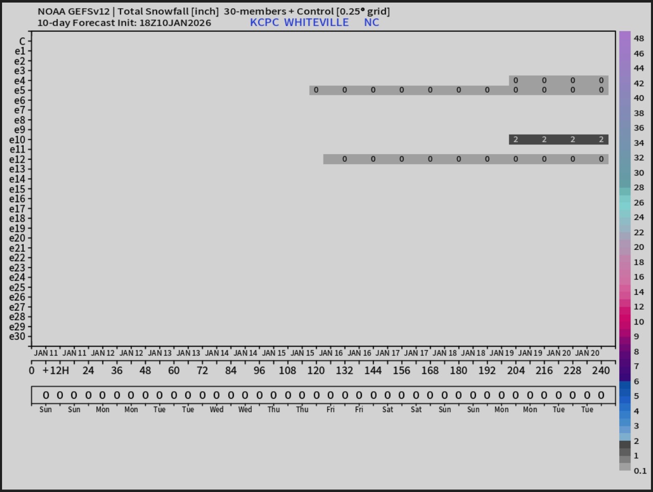
Snowfall in the model guidance (the deterministic modeling anyway) is being driven by upper-level dynamics more than anything else. Folks, I just don’t see it happening. Not this week.
That’ll do it for today’s blog. Thank you for reading! Here’s your Freedom Insurance Today-plus-Five Forecast!
–Meteorologist Christopher Cawley